Far North Queensland was lashed by 300mm of rain in a single day yesterday as the slow-moving trough travelled across the state.
South-east Queensland is in line for three days of drenching and Katherine in the Northern Territory is facing a flood disaster as twin tropical lows that saturated the country's north continues to dump torrential rain.
Far North Queensland was lashed by 300mm of rain in a single day yesterday as the slow-moving trough travelled across the state.
The Daintree region was hit with a deluge of 300 to 400mm of rain in just 24 hours, including more than 200 mm in six hours.
READ MORE: Russia has provided Iran with information that can help Tehran strike US military, AP sources say
There is some reprieve for residents in northern areas like Cairns and Townsville, where most of the rain has passed and a severe weather warning has been cancelled.
The tropical low is trending toward Capricornia and Wide Bay and adjacent interior today, before moving into South East Queensland tomorrow.
The Bureau of Meteorology warning of "significant widespread flooding" over the next few days, with places like the Sunshine Coast expected to be lashed with 200 mm rain in the next 72 hours.
Heavy rainfall leading to flash flooding is likely in Bundaberg, Hervey Bay and Gladstone.
Gladstone was already battered by almost 130mm in six hours overnight.
"We are going to see the moisture associated with the remnants of this tropical low get spread across broad parts of eastern, central and the northern interior of Queensland," senior meteorologist Harry Clark said.
Brisbane is forecast to receive between 10 to 20mm of rain today, 15 to 70mm tomorrow and between 10 and 60mm on Monday.
A severe weather warning is in place for heavy rainfall in the Gulf Country, Northern Goldfields and Upper Flinders and North West districts.
READ MORE: Four teenagers arrested after deadly brawl at Melbourne train station
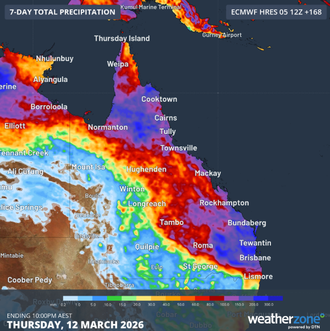
Locations such as Georgetown, Hughenden, Richmond, Croydon, Gregory Springs and Forsayth could see six-hourly rainfall totals between 70 and 100 mm, with isolated totals up to 130 mm possible.
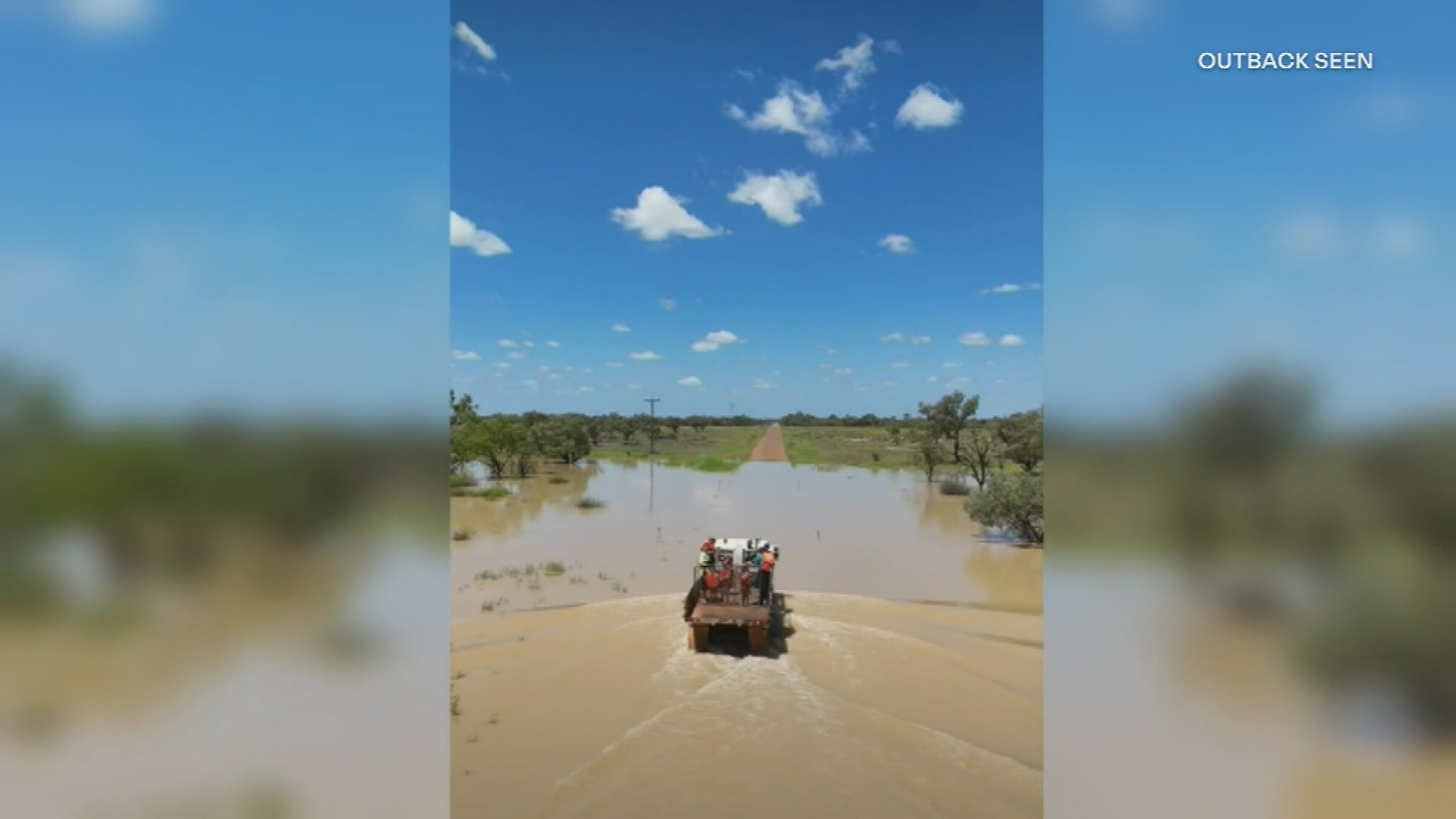
A flood watch is in place for most of Queensland, with major riverine flood warnings earmarked for the Flinders River, Thomson River and Coopers Creek, and Georgina River and Eyre Creek.
The torrential downpour saw the Daintree River swell to 13 metres on Thursday night, causing the local ferry in the Douglas Shire near Port Douglas to tear off its moorings.
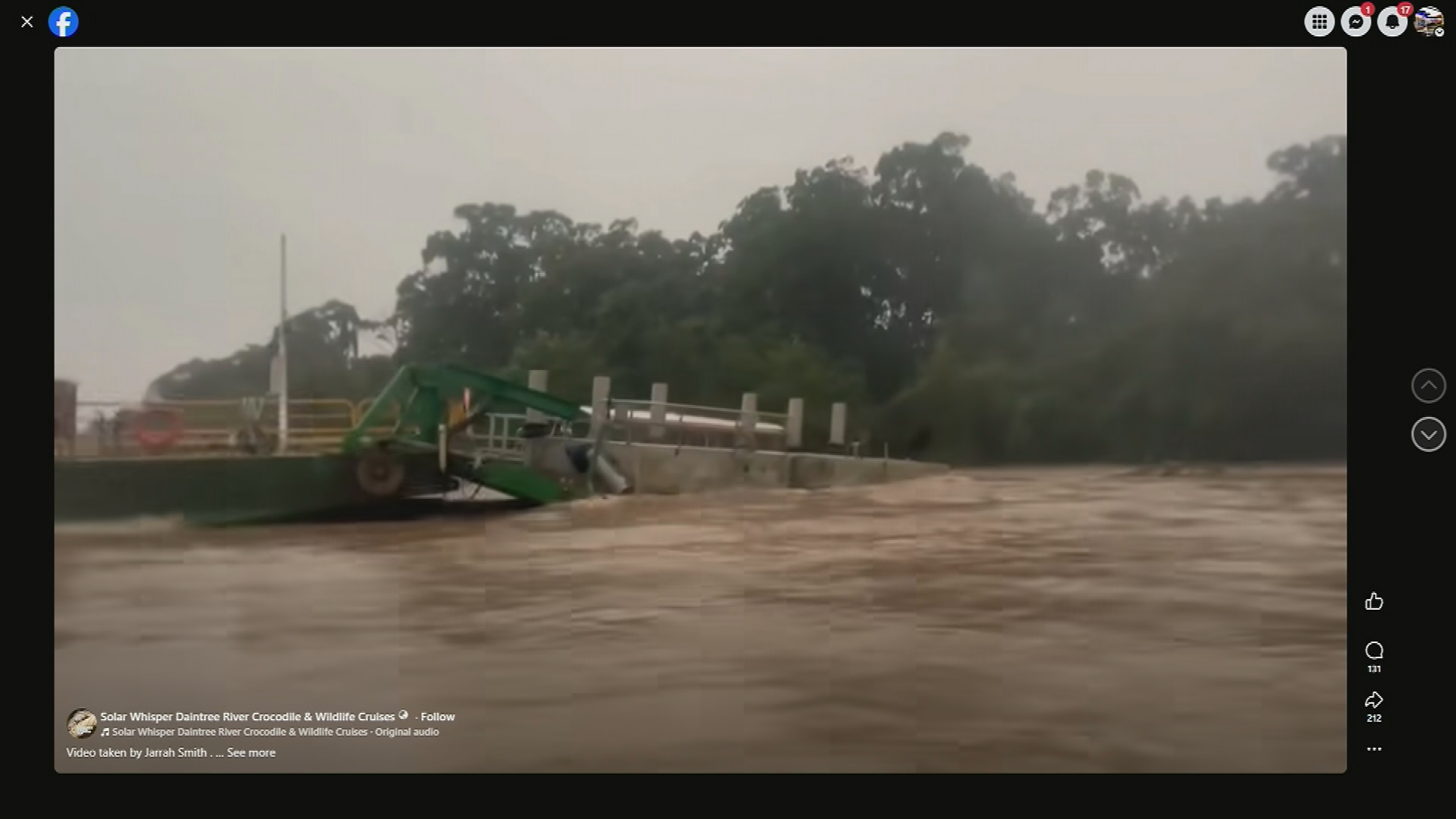
"Our ferry came off its moorings and collided with another boat and pontoon," Douglas Shire Council Mayor Lisa Scomazzon said.
"At the moment we're waiting for the river to become safe so crews can go in and assess the damage.
"It's a big shock to our community because that's the only form access they have to Mossman and Port Douglas."
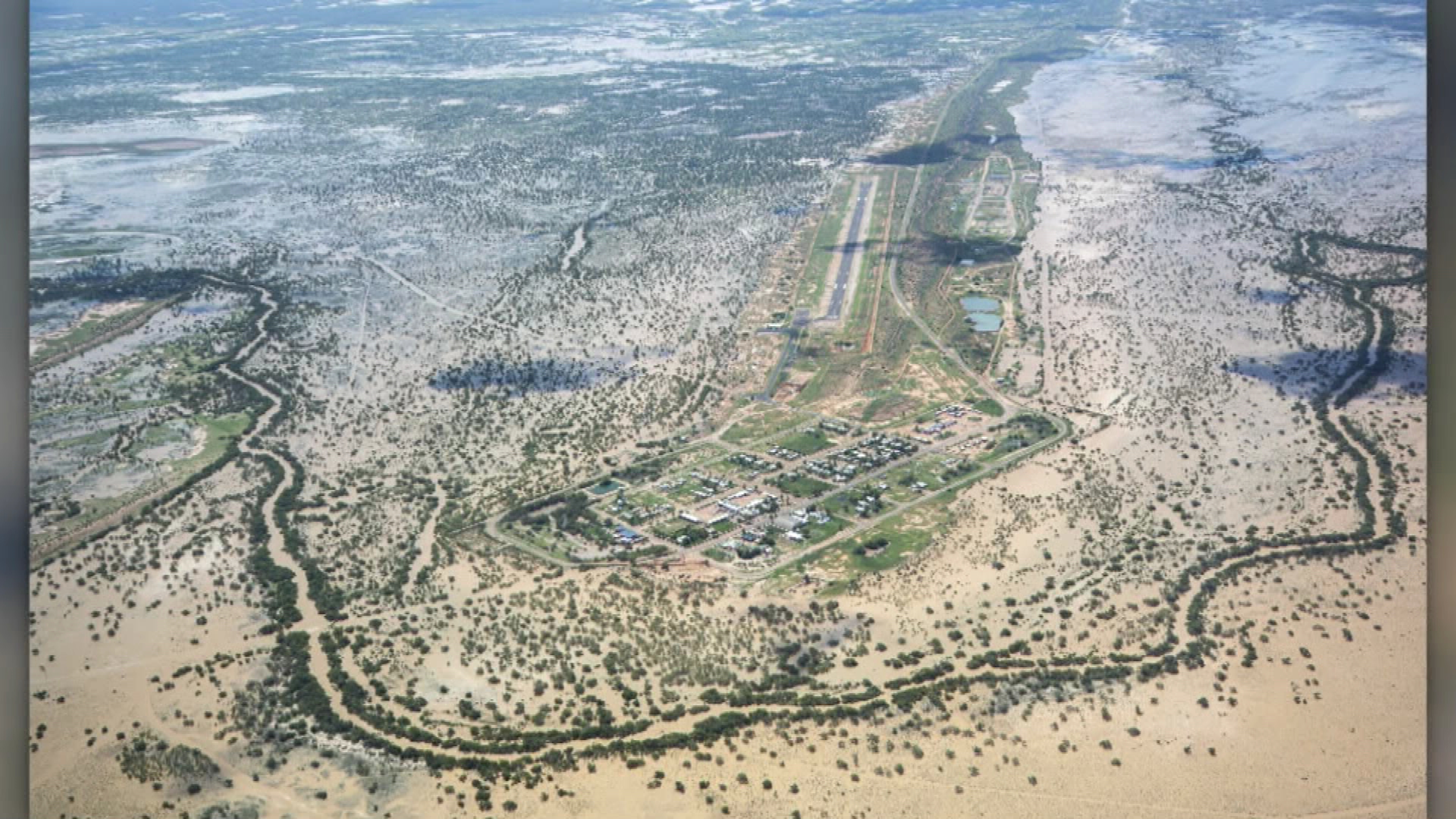
Major flooding inundates Katherine
Meanwhile, Katherine in the Northern Territory is facing its worst flood disaster in decades.
The Katherine River has already surpassed flood levels seen in 2000 at Katherine Bridge, where heights of 18.37 metres have been recorded.
That could surge as high as 19.20 metres by this evening, the Bureau has warned.
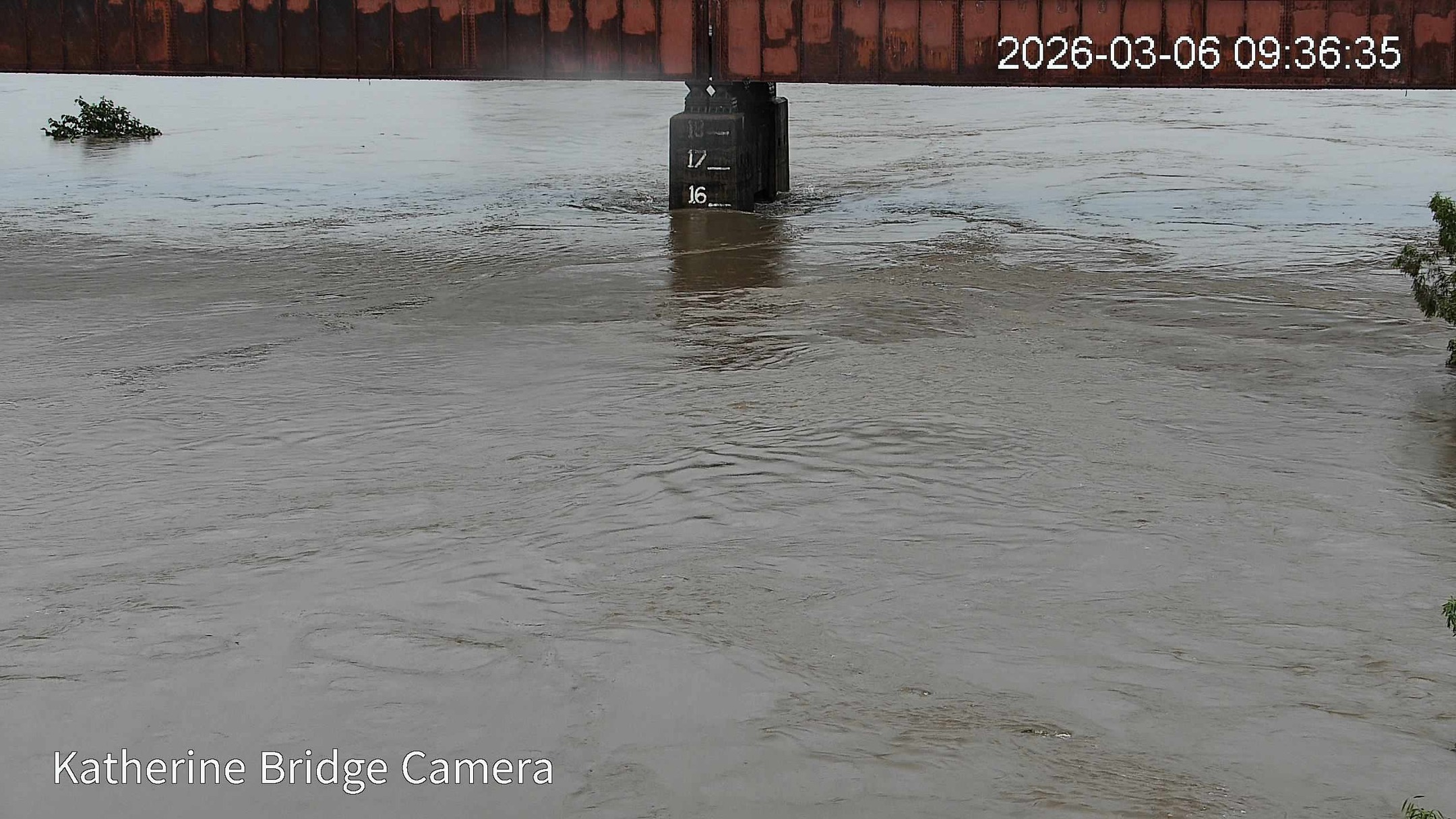
In nearby Nitmiluk, the river has flooded above the April 2006 flood level of 9.5m and rapidly rising.
A major flood warning is in place for the outback town, 300km south of Darwin, as well as nearby Nitmiluk, as the Katherine River rises rapidly.
Further rainfall is expected today, which may cause the river to swell even more.
A severe weather warning for the western Top End has been cancelled after heavy rainfall eased.
Parts of Arnhem Land were hit by between 100 to 155mm of rain in just six hours overnight.
Major flooding is expected along the Daly River from this afternoon.
NEVER MISS A STORY: Get your breaking news and exclusive stories first by following us across all platforms.
- Download the 9NEWS App here via Apple and Google Play
- Make 9News your preferred source on Google by ticking this box here
- Sign up to our breaking newsletter here
 DFAT shuttle buses to help stranded Aussies
 Entertainer Jamie Dunn, voice behind beloved puppet Agro, dies aged 75
 Wife's plea over camera after husband killed in Bondi terror attack
 Porn giant blocks Australian website access over new age-check laws
 Explosions rock Iran's capital as US warns bombing will intensify
 Russia has provided Iran with information that can help Tehran strike US military, sources say
 Man allegedly stabbed two people after carjacking ATV
 Melbourne teens arrested over deadly station brawl
 'I did not quit': Jackie O breaks her silence
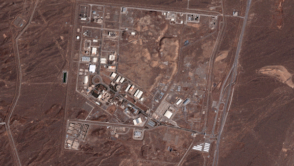 Satellite images show the extent of US-Israeli attacks across Iran
 Tony went through 'hell' due to unnecessary surgery as a child
 Country by country, here's how the unfolding war is affecting the Middle East and beyond
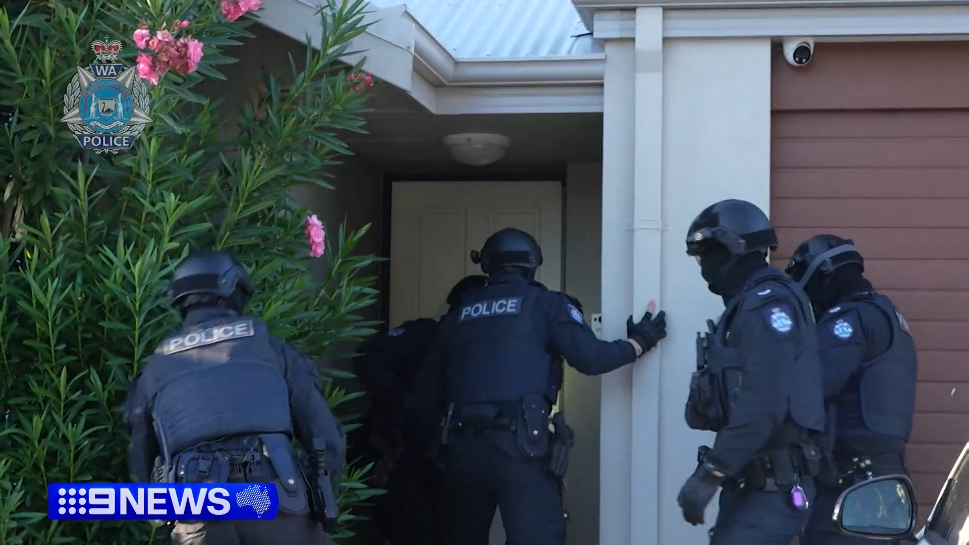 Police launch co-ordinated raids on outlaw motorcycle gangs across Australia and NZ