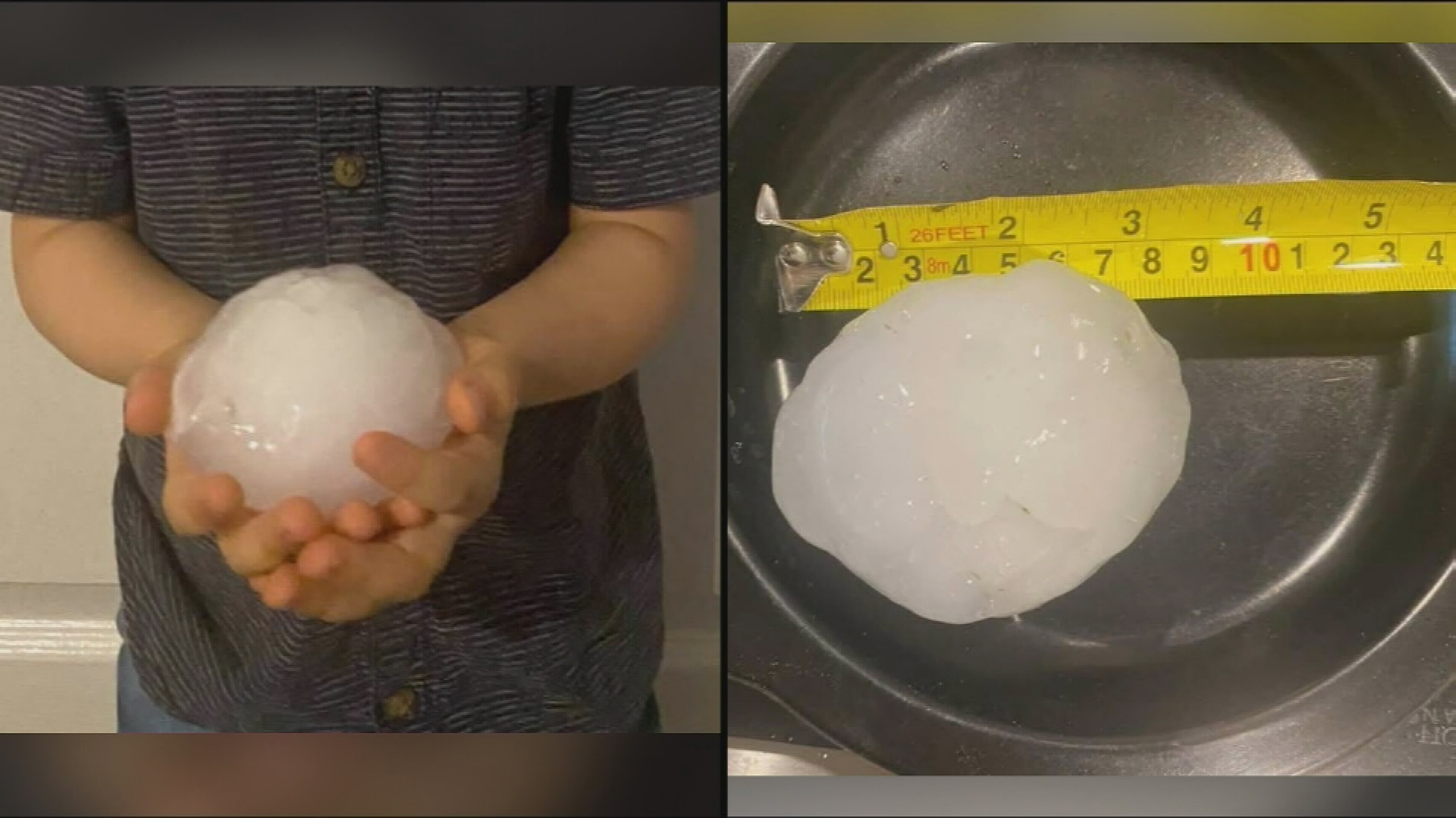
Thunderstorms have walloped south-east Queensland, ripping roofs off homes, tipping cars and dumping cricket-ball-sized hail.
More than 100,000 homes and businesses are without power after thunderstorms walloped south-east Queensland, ripping roofs off homes, tipping cars and dumping cricket-ball-sized hail.
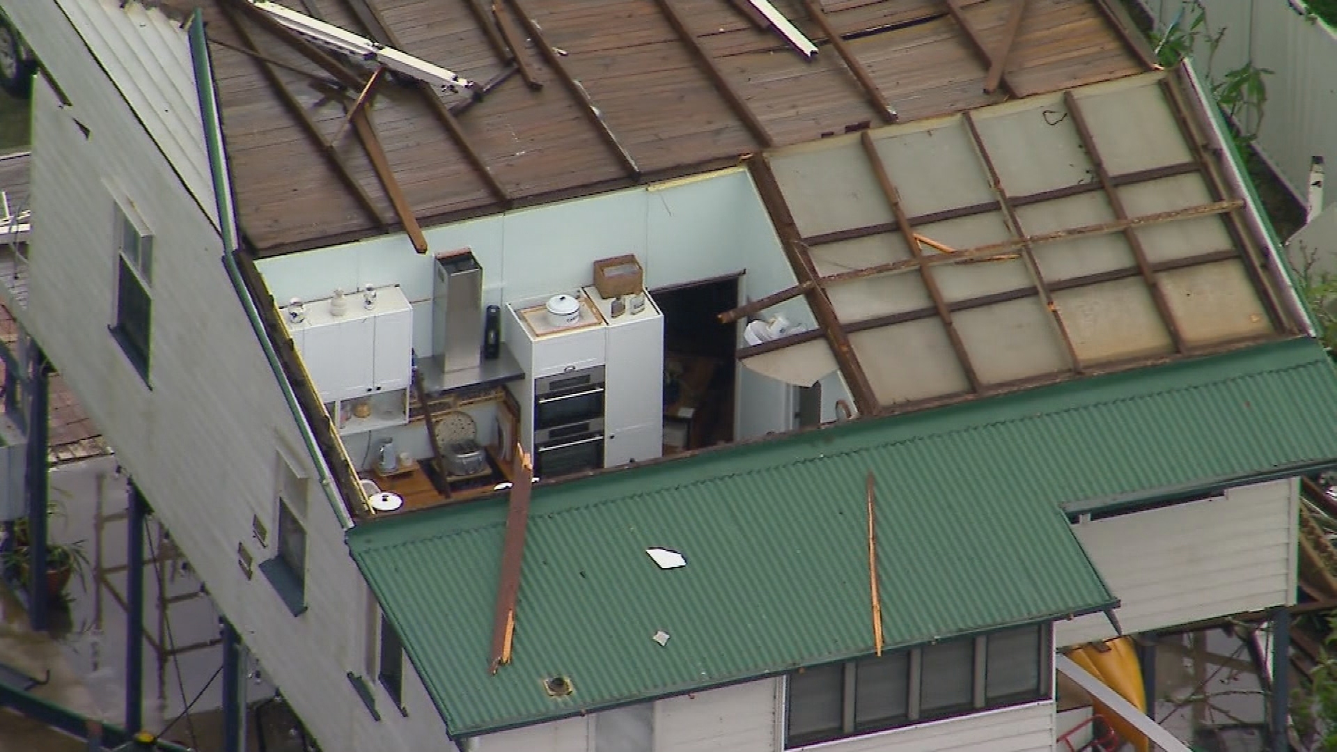
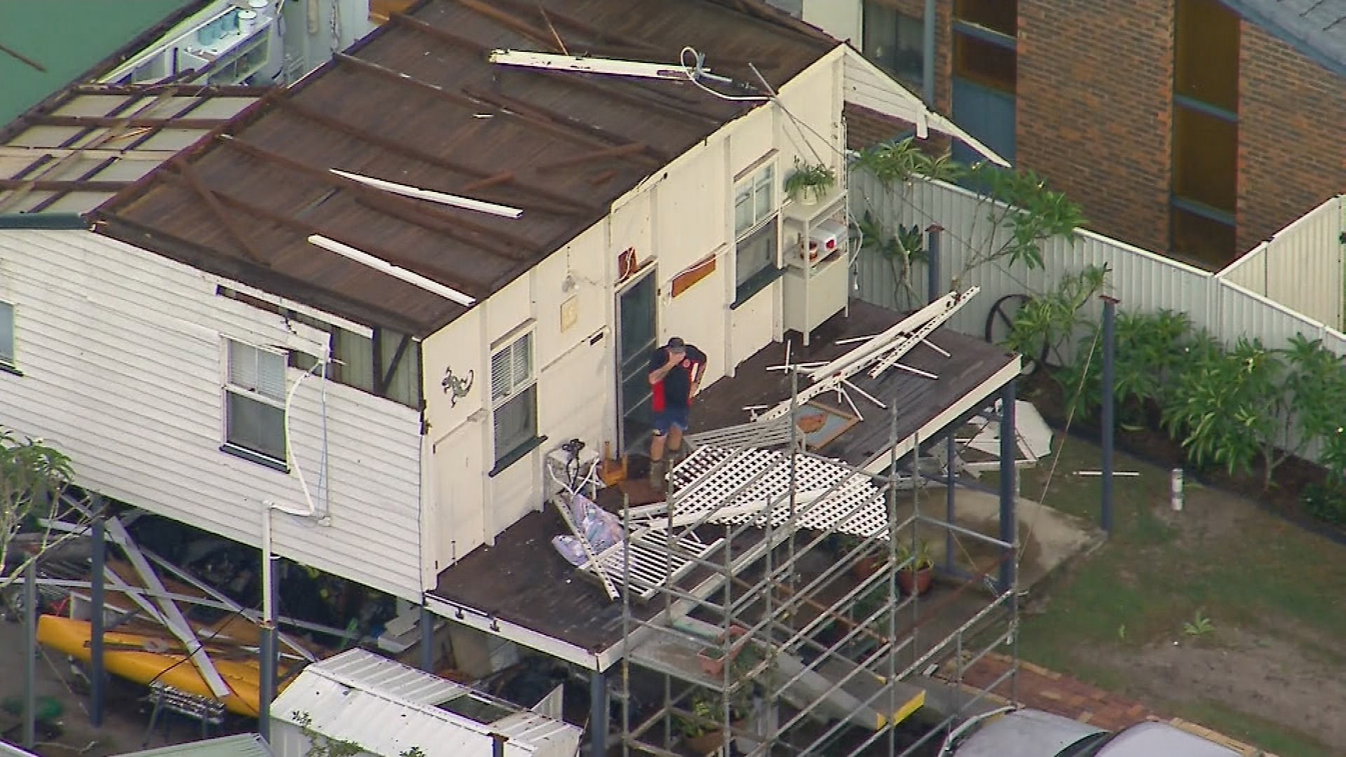
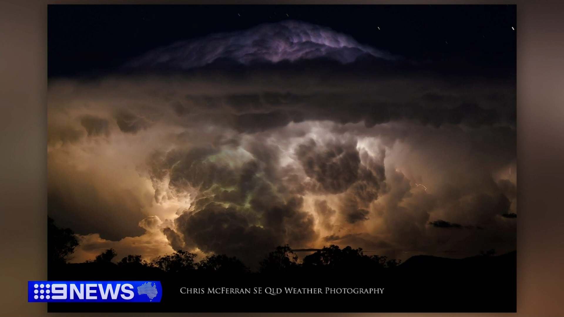
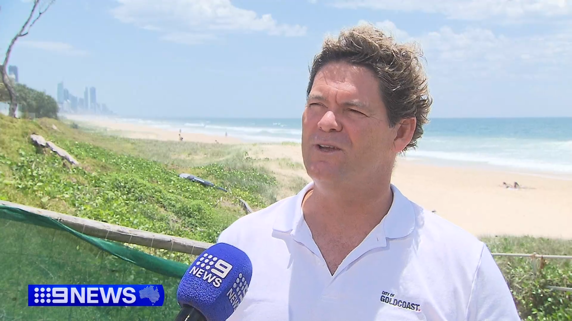
The parade of destructive storms formed in the Gold Coast hinterland early this afternoon and rolled north, causing the worst damage on Bribie Island, north of Brisbane.
Helicopter footage showed the roof peeled off one home, leaving the kitchen exposed to the elements and the resident on the destroyed back patio, shocked by the damage.
READ MORE: Arrest after teen allegedly stabbed to death near school
Trees were uprooted across the island, east of Caboolture, damaging buildings and cars and taking down powerlines, leaving 140,000 without power at the peak, including almost 70,000 in the Moreton Bay region. The overall figure dropped to about 110,000 overnight.
Locals were seen hauling fallen trees off roads to clear a path.
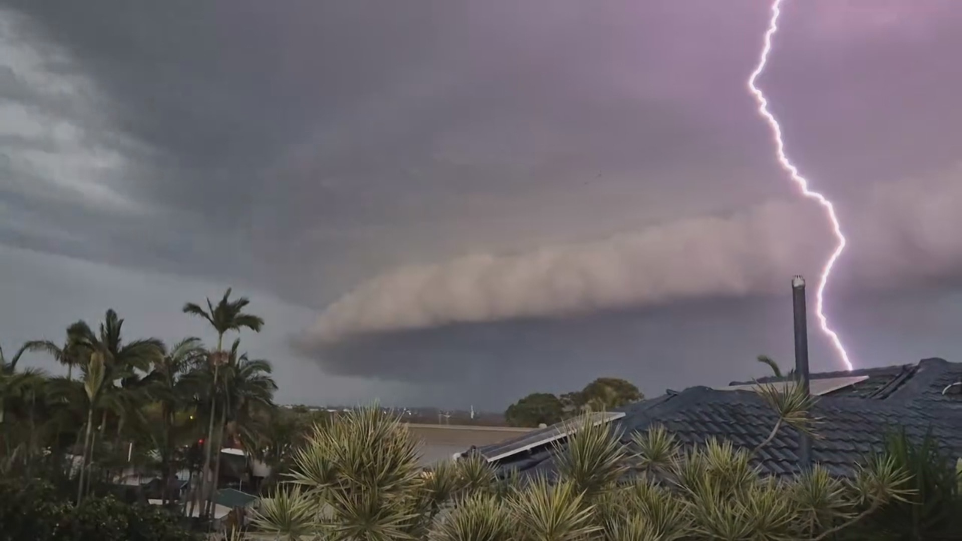
The storm only lasted a few minutes but there was widespread damage in other parts of the region too.
A roof peeled off a service station and flew into power lines in Beaudesert and hail, some as big as cricket balls, belted backyards from Cornubia, south of Brisbane, to Maleny, on the Sunshine Coast hinterland.
Manly, Ferny Hills and Alexandra Hills all copped 11-centimetre hail, with 14-centimetre hailstones recorded in Chandler.
In Loganlea, a carport crashed down, taking power lines with it and forcing two people inside to evacuate through a neighbouring fence.
READ MORE: Parents break silence over horror jet-ski death
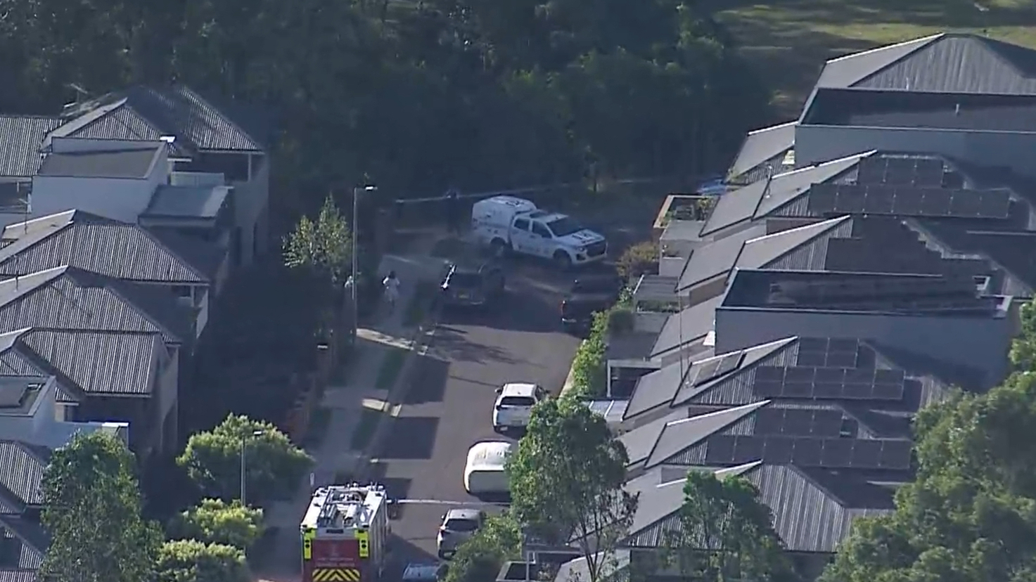
A big clean-up job was already under way this afternoon after the State Emergency Services received more than 1000 callouts by 6pm, mostly in Brisbane, Redlands and Logan.
Severe thunderstorm warnings for several regions were cancelled later tonight.
The severe weather came the day after the area south of Brisbane was thrashed by hail as big as golf balls last night, caused by a supercell that roared across the Scenic Rim and Logan, Weatherzone said.
Locals were warned earlier today there was a chance of more dangerous supercell storms in south-east Queensland and across the border in Murwillumbah.
READ MORE: Fina strengthens to category 4 on path to Western Australia
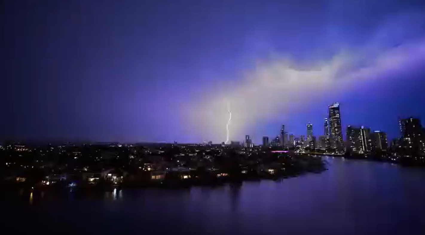
"Monday has all the ingredients for further severe thunderstorm development over northeast NSW and southeast Qld," Weatherzone meteorologist Ben Domensino said earlier today.
"Monday's severe thunderstorms are likely to cause heavy rain, damaging wind gusts in excess of 90 km/h and large hail measuring larger than 2cm in diameter in some areas.
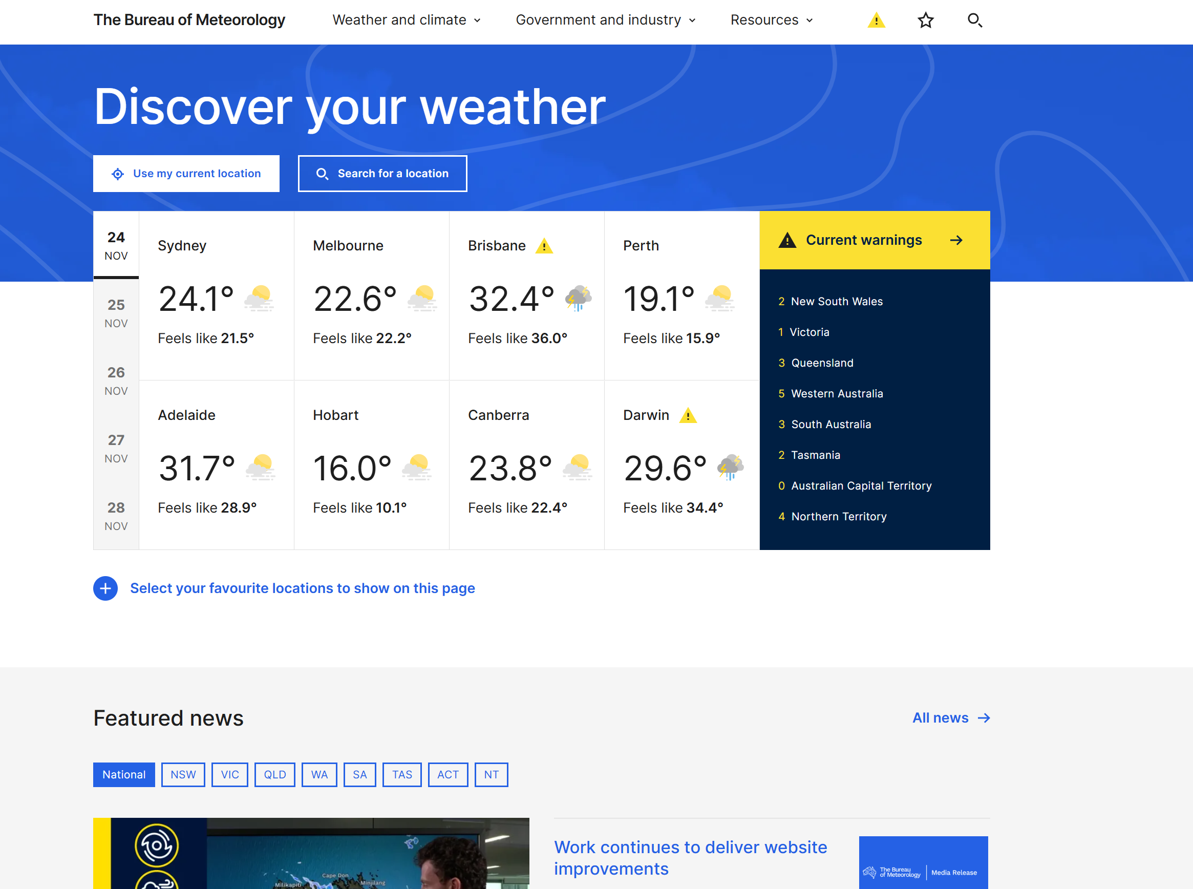
The Bureau of Meteorology also issued warnings.
READ MORE: NT cyclone bringing huge temperature surge around the country
"A warm and humid airmass is combining with a southerly wind change and a low-pressure trough to trigger severe thunderstorms across the Northern Rivers this afternoon." it said.
"Severe thunderstorms are generally moving to the north and northeast and are expected to contract towards the Queensland border. Severe thunderstorms also moving into the southwest of the State."
Storms are forecast for the rest of the week.
Last week thousands were left without power after a storm smashed the Brisbane region.
DOWNLOAD THE 9NEWS APP: Stay across all the latest in breaking news, sport, politics and the weather via our news app and get notifications sent straight to your smartphone. Available on the Apple App Store and Google Play.
 Teen arrested after 17-year-old allegedly stabbed to death near school
 Thai woman found alive in coffin after being brought in for cremation
 Parents of boy killed in jet ski accident say death was preventable
 Australia made a world-first move. Others are copying
 'Absolute chaos': Police recount fatal Sea World chopper crash
 Apple Watch lost at sea reclaimed after month-long journey
 Pauline Hanson wears burqa in Senate chamber in repeat of earlier stunt
 Union calls for Melbourne metro opening delay as premier insists it's safe
 Reggae giant and The Harder They Come movie star Jimmy Cliff dead at 81
 Bureau of Meteorology asked to explain why new website cost $92 million more than reported
 Four charged after $170 million worth of cocaine found floating off WA
 Nine out of 10 employers fearing for staff's safety as retail crime rises
 'Human filth': James Packer unleashes on ex-premier
 Regional Queensland among least affordable for renters across country
 Skye Gyngell, the first Australian woman to win Michelin star, dies aged 62
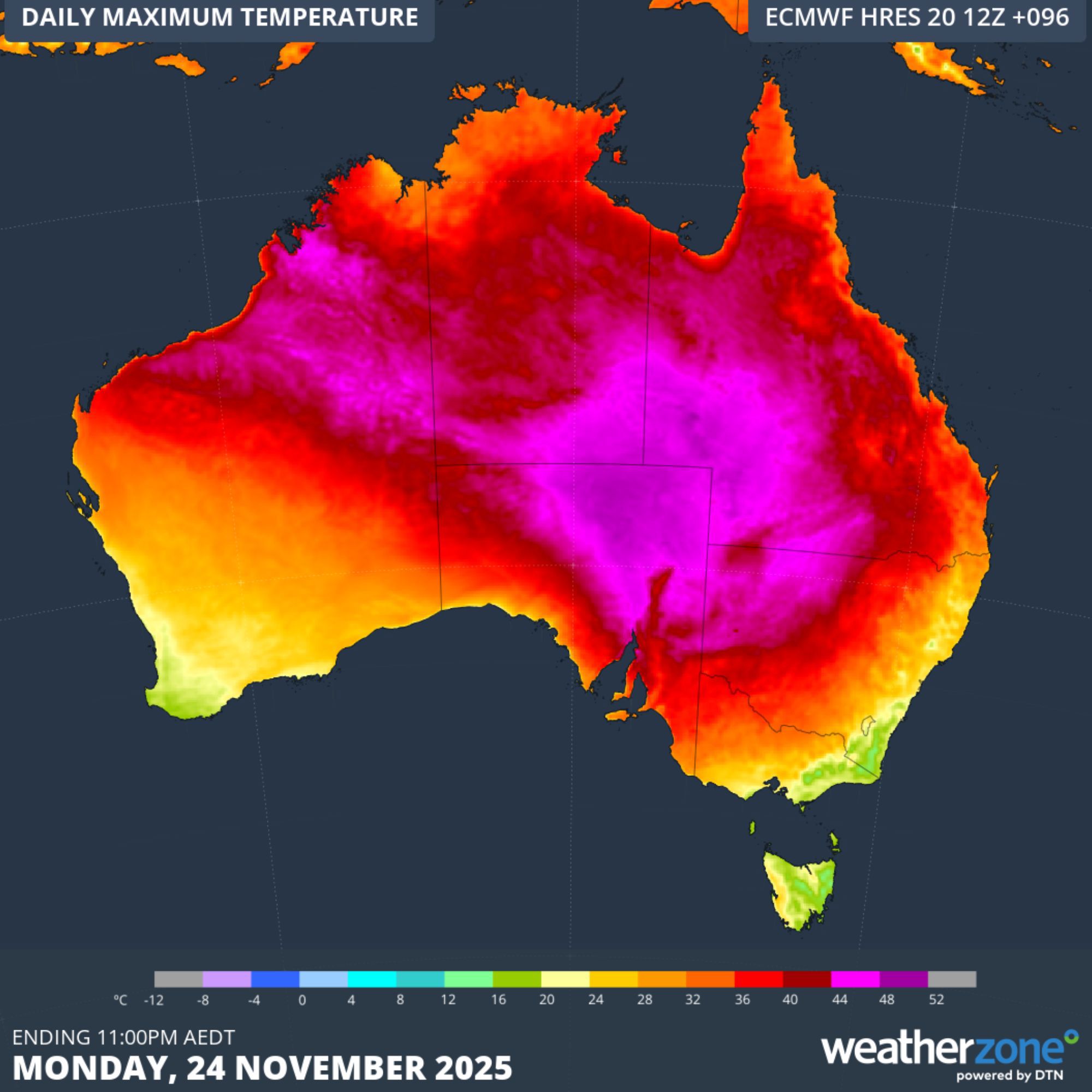 NT cyclone bringing huge temperature surge around the country
 Chris is only 17 but he and his schoolmates worry they won't ever afford a house
 Doesn't exist': DOGE is done for – eight months early
 UK PM says Andrew should testify in US Epstein probe