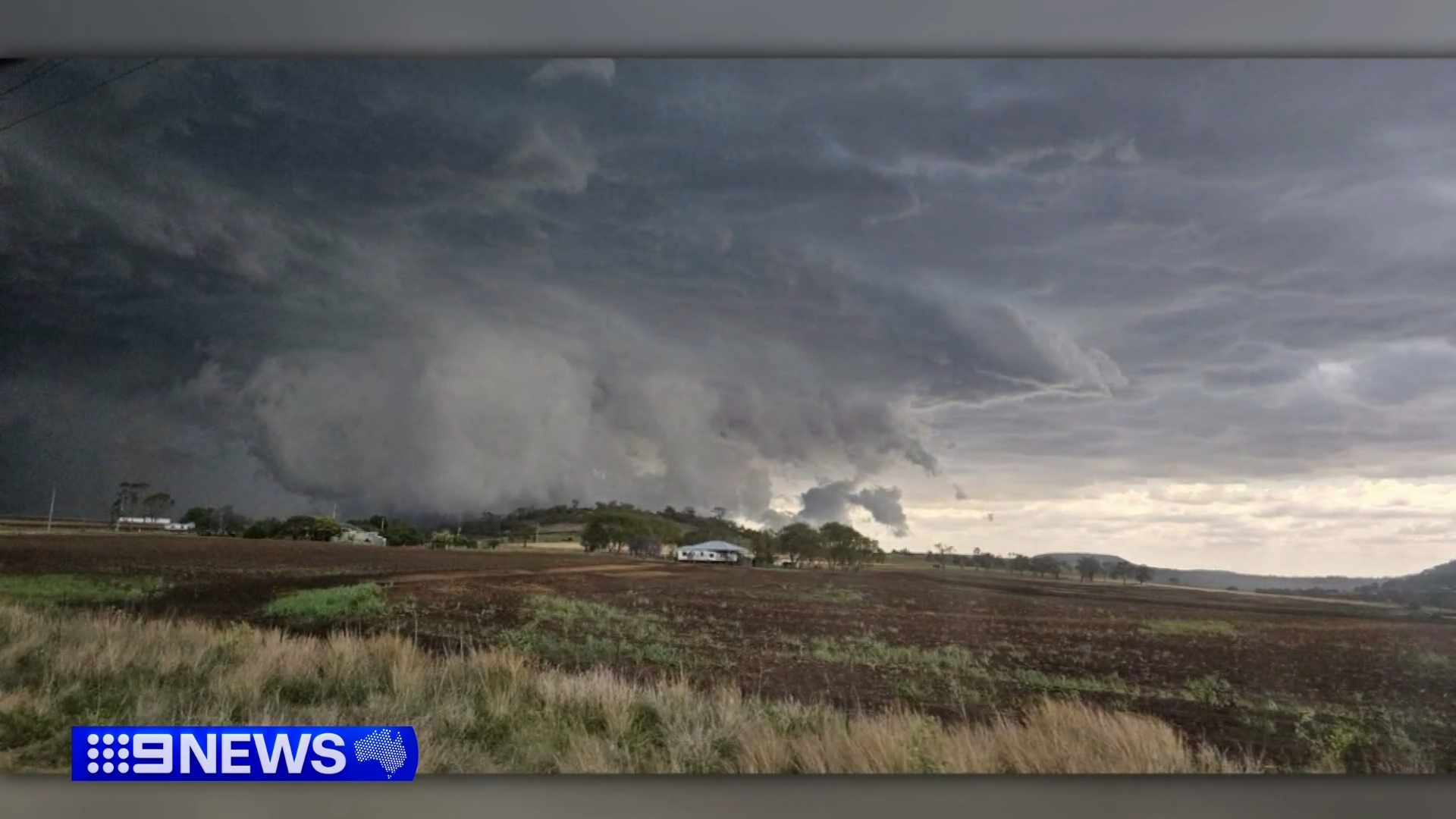
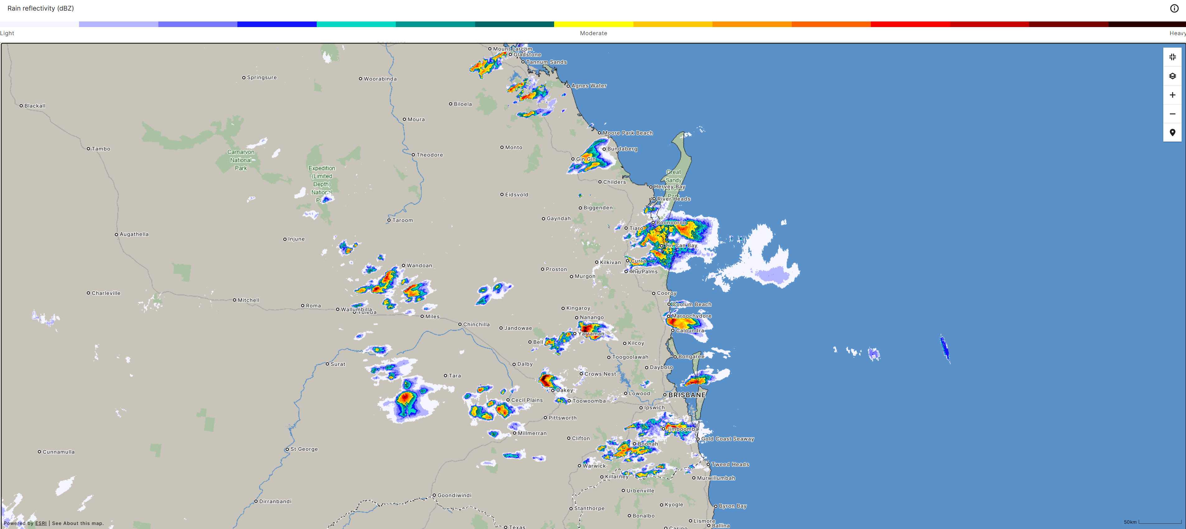
A dangerous 'super cell' storm has struck southeastern Queensland bringing large hail, lightning and cutting power to hundreds.
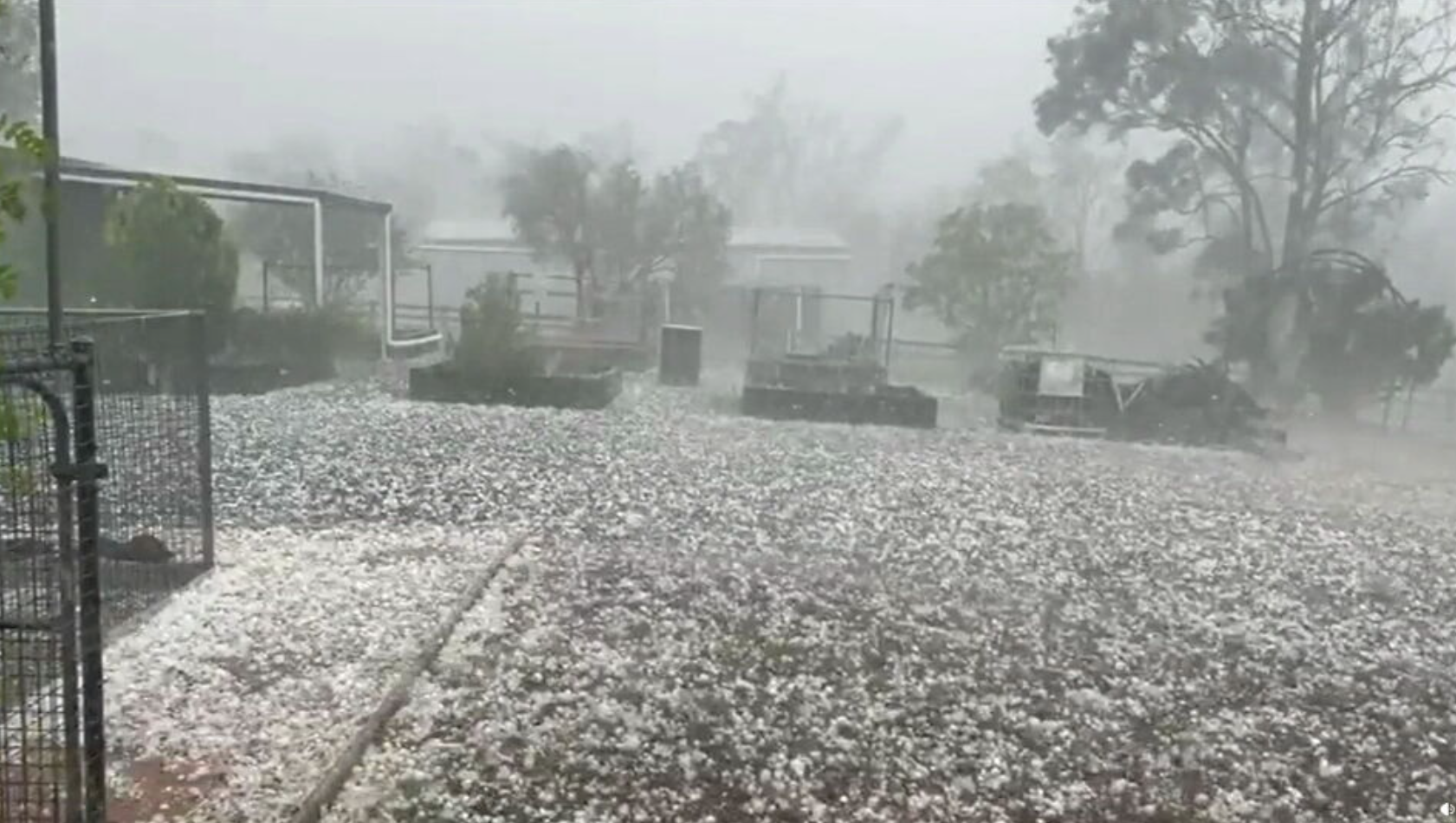
Hail, thunder and lightning has hit south eastern Queensland, cutting power to hundreds.
Authorities have warned residents in northern NSW, the Gold Coast, Brisbane and the Sunshine Coast to stay inside tonight, as 'super cell' thunderstorms move across the area. Severe storm warnings remain in place as at 10pm.
The storm struck Queensland's Southern and Darling Down region around lunchtime, bringing hailstones as large as nine centimetres.
Check for the latest weather warnings via the Bureau of Meteorology here.
Hail, 5cm-8cm, fell across Toowoomba, Gatton, the Sunshine Coast, the Lockyer Valley and Brisbane as heavy rain continued to drench the region.
Lightning and dark clouds rolled in over Brisbane about 3pm, resulting in power cuts to almost 700 residents in Bowen Hills.
The Bureau of Meteorology (BoM) warns for damaging winds, large hail and heavy rainfall, which could result in flash flooding, across northern NSW and much of Queensland.
"When it comes to the wind, there is even an outside chance that we could see a tornado or two touch down with the most intense, most severe thunderstorm cells later on today," BoM meteorologist Angus Hines said.
READ MORE: Man's new Tesla struck by suspected meteorite on remote Aussie highway

The worst of the storm is expected to hit Surfers Paradise, Gold Coast, the Brisbane metro area, the Sunshine Coast, Maleny and Noosa Heads.
The Burnett region, Kingaroy and Gympie, as well as Biloela and Toowoomba are also in the firing line, Bureau of Meteorology meteorologist Angus Hines said.
Residents in the NSW Northern Tablelands and across the North West Slopes and Plains, including Tamworth and Moree are also expected to be hit by the storms.
Coastal areas such as Port Macquarie, Coffs Harbour, Grafton, Ballina, Lismore and Byron Bay are also in the firing line.
READ MORE: 'Taken in a minute': Tributes for woman killed in freak lightning strike
Residents have been advised to pack away or secure outdoor furniture, toys and trampolines, park cars away from trees, close doors and windows.
The Bureau urged locals across northern NSW and south eastern Queensland to remain inside a "strong building" until the storm passes and advised against driving.
The state has been hit with severe thunderstorm weather for almost a week.
However, authorities have urged locals to keep up to date with the Bureau of Meteorology weather warnings due to how quickly the weather can turn.
Rainy conditions and storms in some areas may continue tomorrow, but overall conditions are expected to improve.
Inland areas from Brisbane to Bundaberg may still see severe thunderstorms tomorrow.
DOWNLOAD THE 9NEWS APP: Stay across all the latest in breaking news, sport, politics and the weather via our news app and get notifications sent straight to your smartphone. Available on the Apple App Store and Google Play.
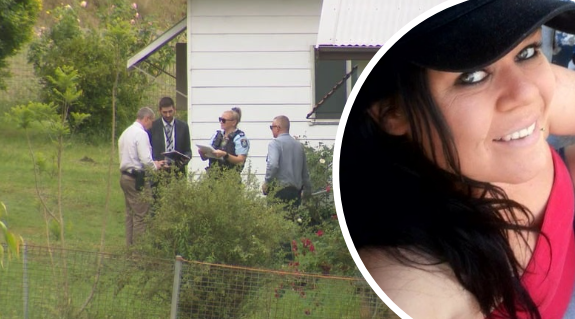 Man arrested after woman found dead in Hunter Valley home
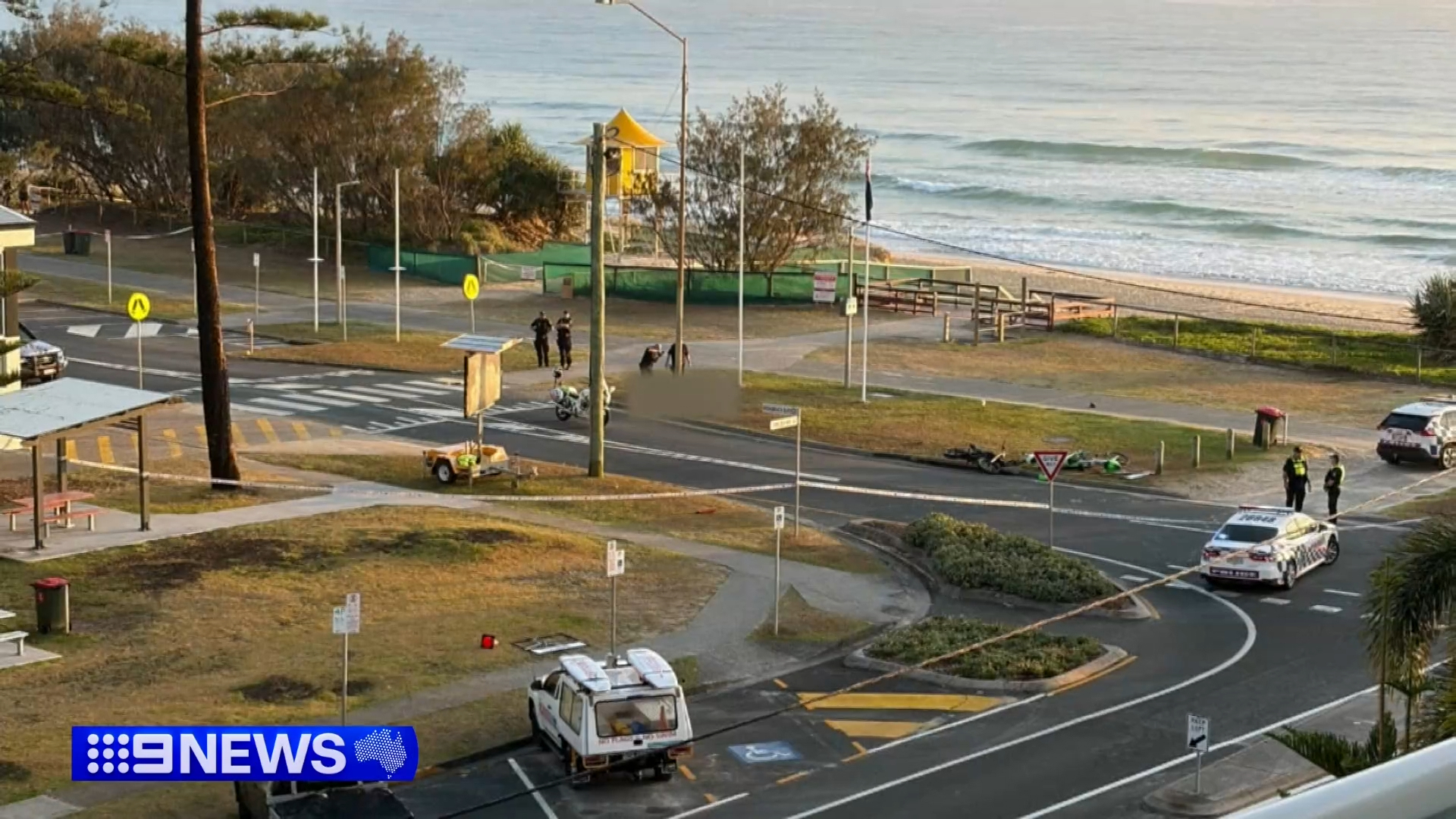 Teen dies after electric dirt bike crash on the Gold Coast
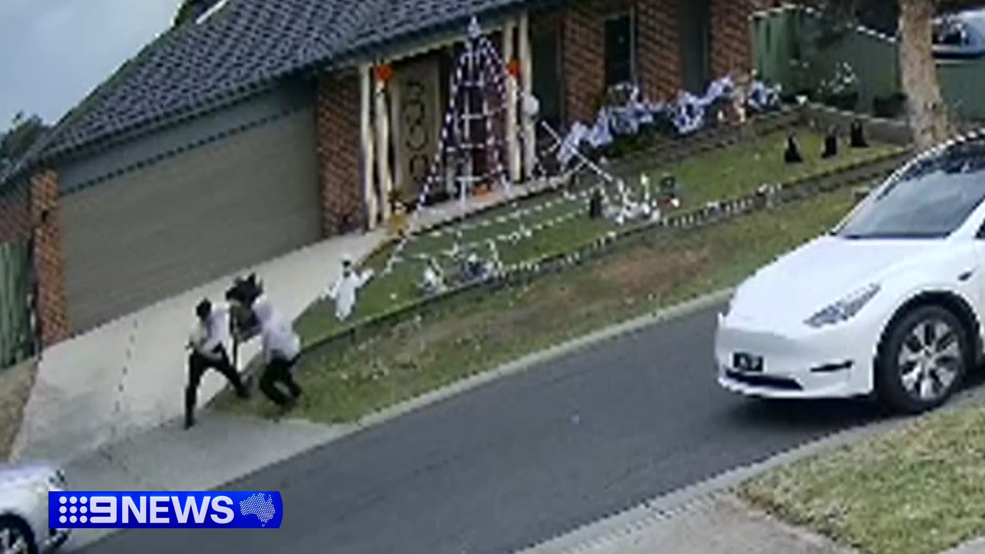
 Halloween house-party explodes into chaos in Perth
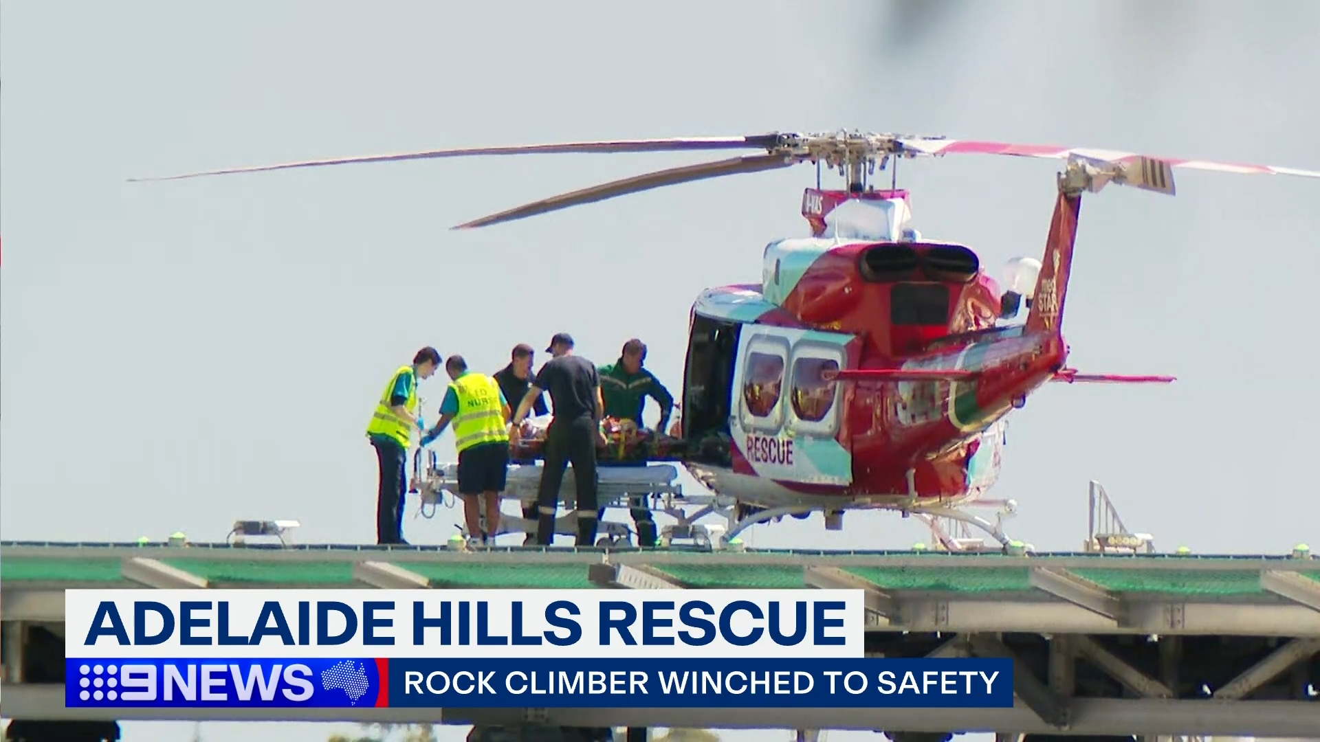 Rock climber's dramatic rescue after getting tangled in ropes
 Beers recalled over fears cans could 'burst'
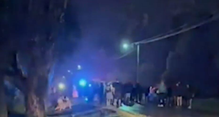
 Melbourne teen injured in street fight as families celebrate Halloween
 'Morons': Liam Gallagher blasts fan after first Oasis gig in Melbourne
 Trips to the doctor just got cheaper thanks to $7.9 billion overhaul
 Are Christmas advertising and promotions getting earlier each year?
 BoM backflips on controversial rain radar on new website
 Bank that sacked thousands of Aussies hit by $1.1 billion blow
 If you have this passport, you might be called on for compulsory military service