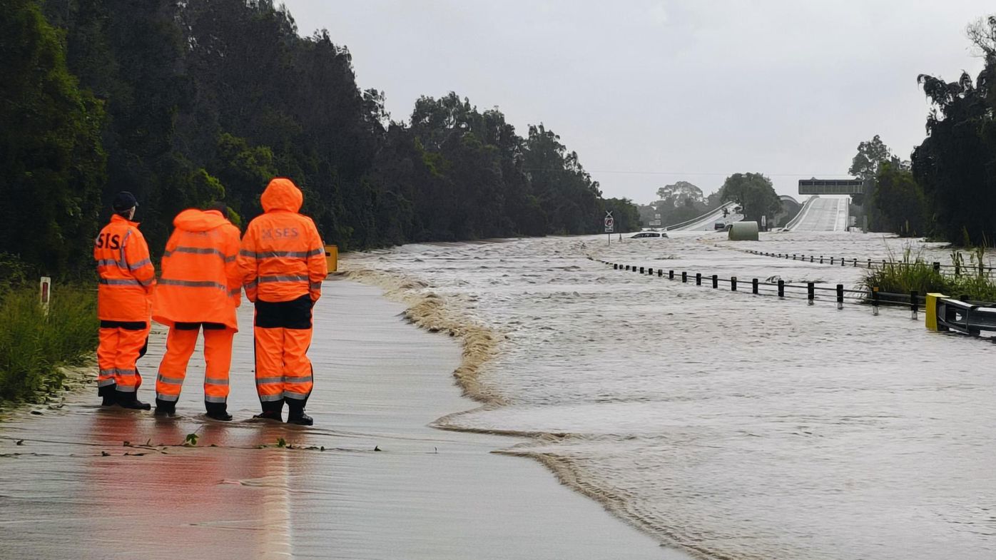
The SES has urged the community to stay aware and heed advice as an unpredictable and complex weather system threatens to unleash flooding across the region.
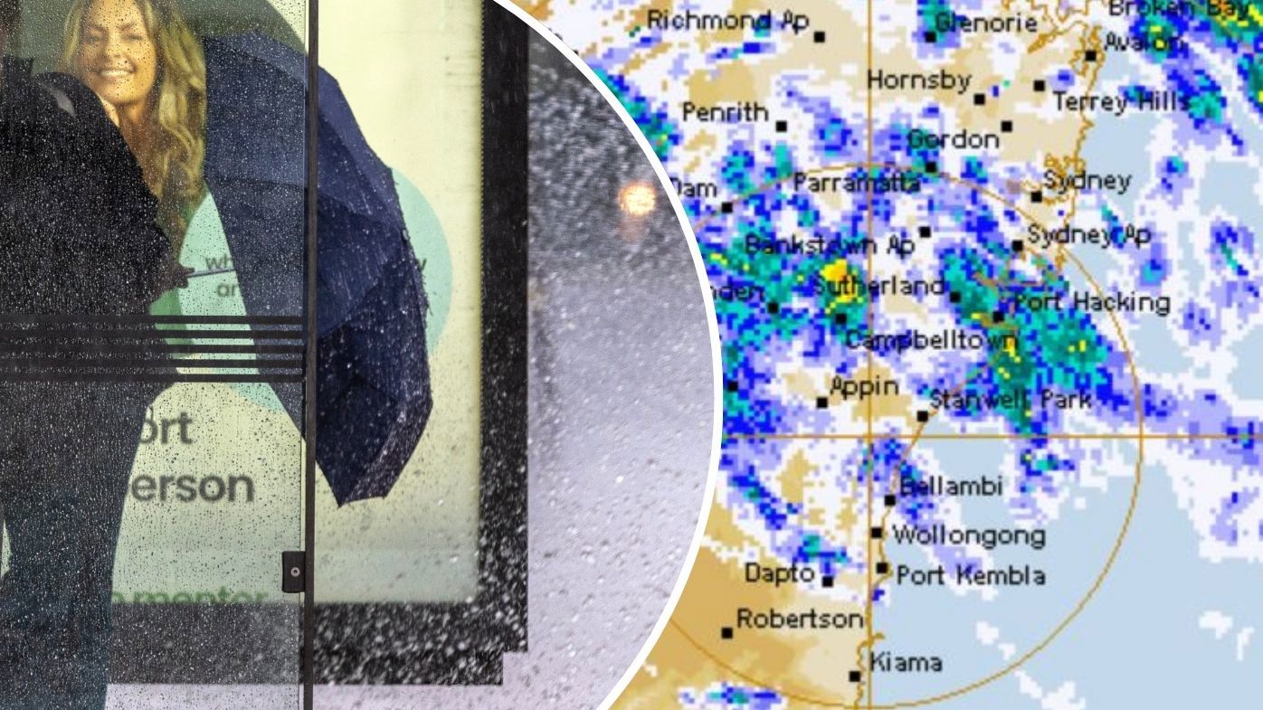
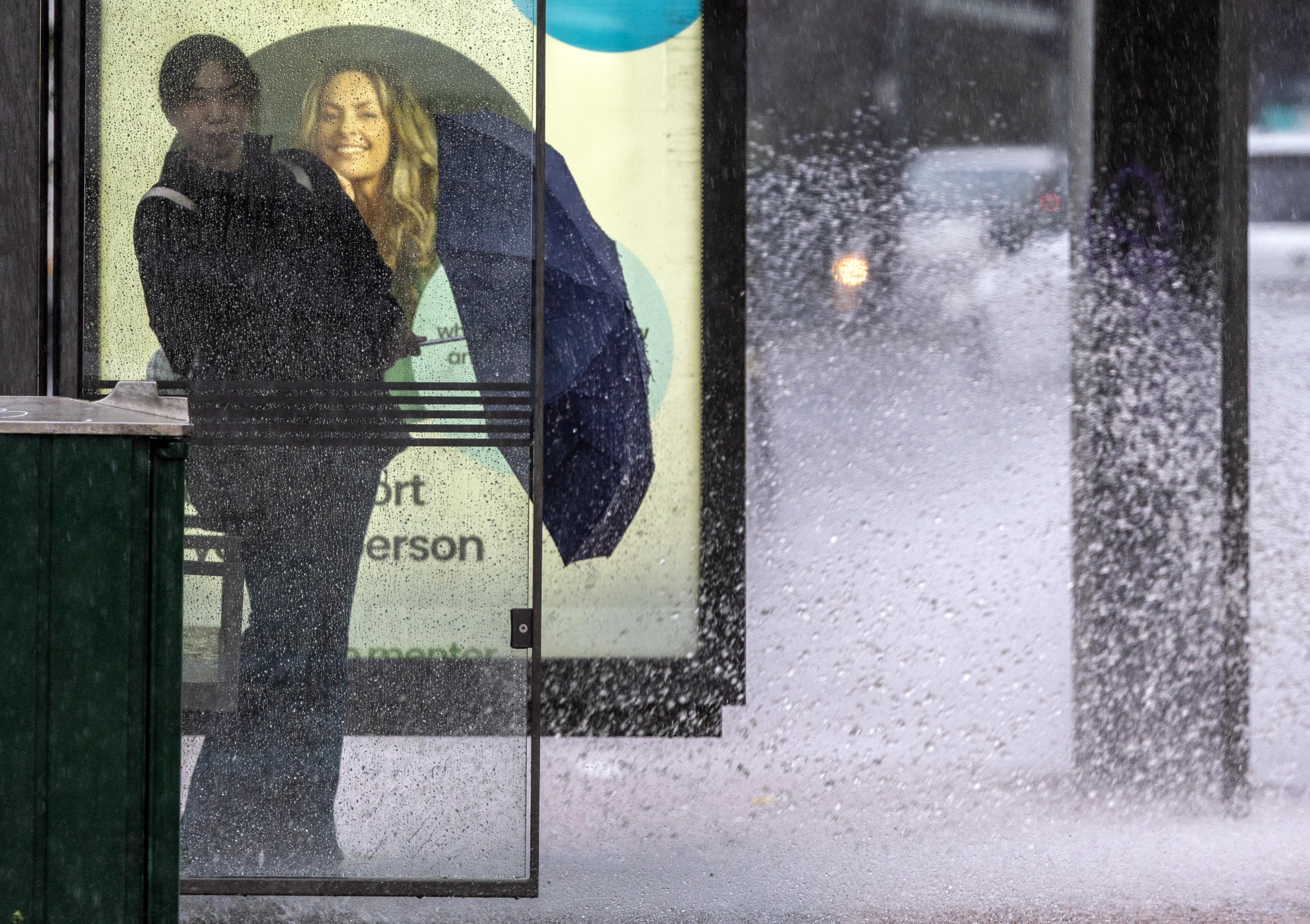
Millions of residents across large parts of NSW including Sydney have been warned to brace for "significant and intense" rainfall over the next three days.
The SES has urged the community to stay aware and heed advice as an unpredictable and complex weather system threatens to unleash flooding across the region.
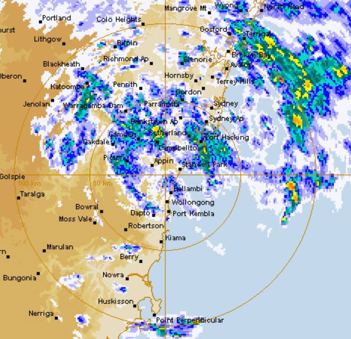
Flood watches and warnings are in place up and down the NSW coast as a rainbomb lingers over most of the state, with a warning of thunderstorms and high winds in many parts.
READ MORE: US destroyers head toward Venezuela as Trump aims to pressure drug cartels
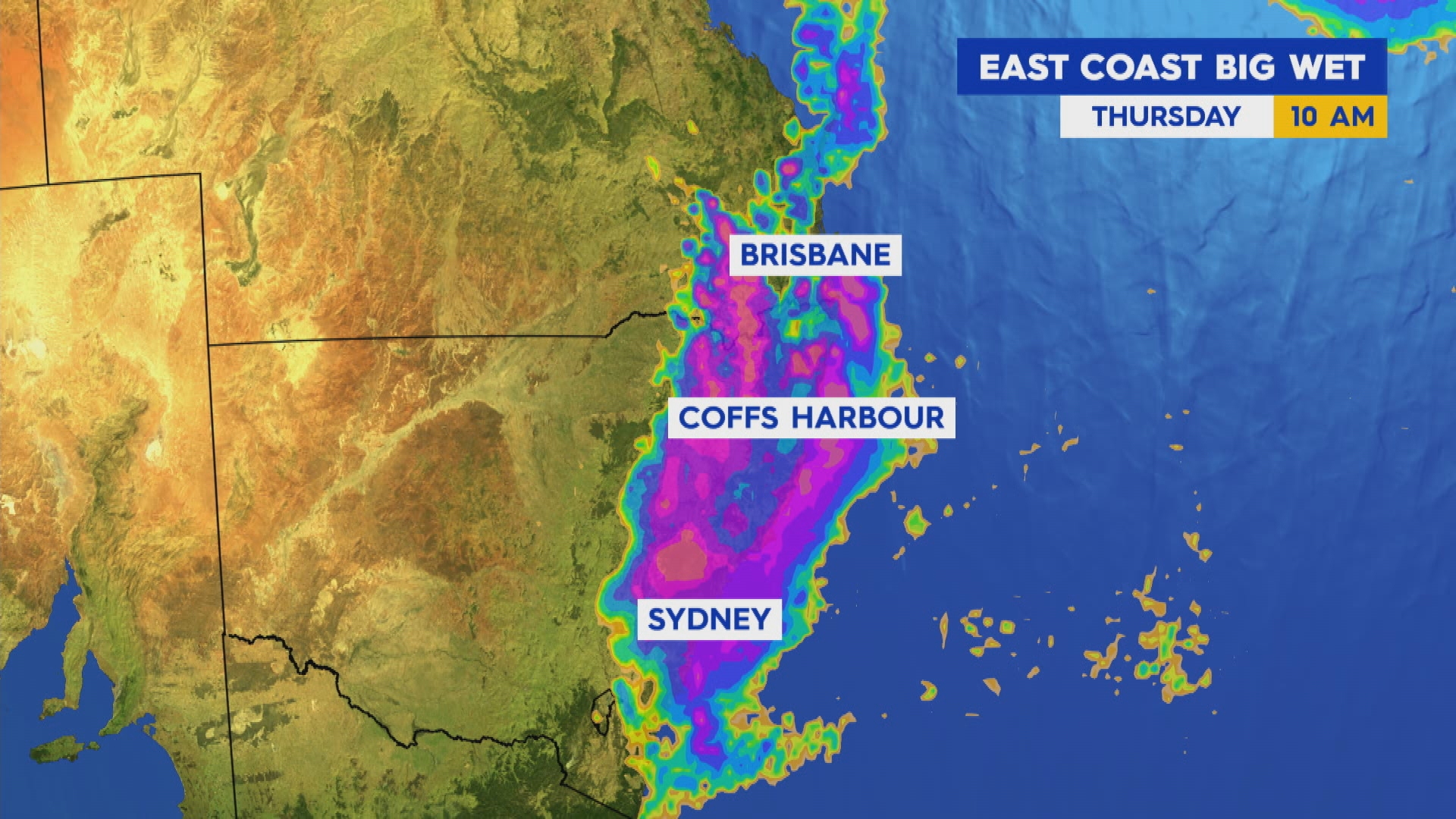
Today is expected to bring around 25-45mm of rain acoss the east coast from Jervis Bay up to south-east Quensland, with isolated totals of 75mm possible.
Tomorrow will be worse with a widespread forecast of 20-80mm and isolated 120mm totals expected for the same communities on the NSW coast.
The rain is forecast to ease off by late Friday, however 60mm isolated rainfalls could be possible on the northern NSW coast.
Greater Sydney and the CBD is also forecast to be battered by more rain over the next three days.
Bureau of Meteorology manager of hazard preparedness Steve Bernasconi said the widespread, moderate to heavy rainfall is due to a high-pressure system in the southern Tasman Sea drawing in moist air.
"This may not seem like a lot [of rain], but over three days it is," Bernasconi said.
"What we have here is a significant rain event impacting most of the state.
"The main issue is flooding."
Lingering showers could persist on Saturday however the bureau expects the high pressure system will start to move out to sea.
Bernasconi said most of the rain will come in the afternoon and evenings.
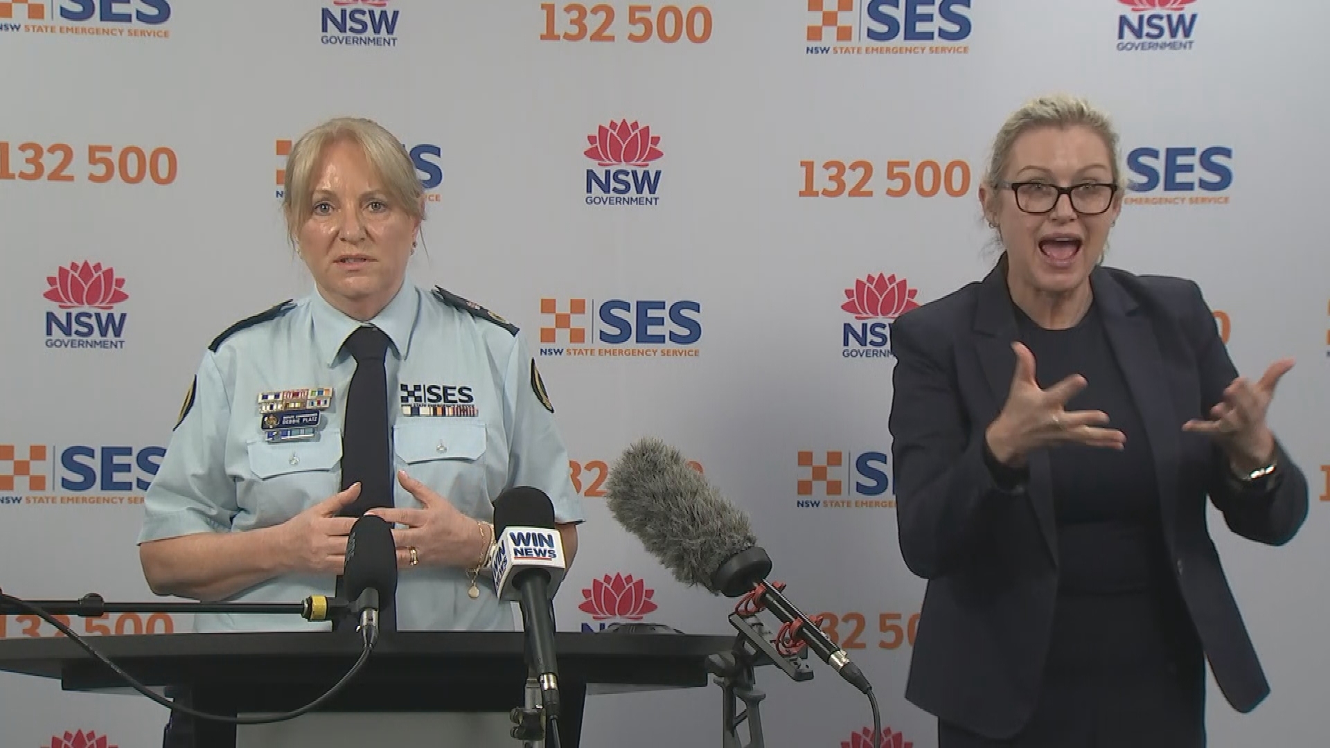
SES deputy commissioner Deb Platz said residents who have already weathered several major flood events this year should not be complacent.
Platz urged everyone in the impacted regions to keep across the latest flood advice.
"This year we have seen significant weather events, significant flooding and a lot of damage. We know the community is tired and volunteers are tired," she said.
"Complacency is always a risk.
"We know people are tired… think of your family, friends, colleagues and neighbours.
"This is likely to continue for the rest of he year. We are urging the community to keep safe."
The SES has fielded 330 calls and responded to 120 incidents so far.
Road closures are expected as rain batters the state, particularly in flood catchment areas.
Flash flooding in low-lying areas is anticipated.
"We are encouraging you all to keep an eye on the SES website and the Hazards Near Me app," Platz added.
Flood watches across the state
A flood watch has been issued for parts of the Mid North Coast, Hunter and North West Slopes, with minor to moderate flooding likely from late today and isolated major flooding possible.
Minor to moderate flooding is also possible in the Hunter and Colo River catchments from tomorrow morning.
READ MORE: Man killed in Sydney's second public shooting in days
Rainfall is forecast to develop west of Tamworth in the state's north-east from today, with moderate 24-hour totals of 30mm to 45mm likely, and isolated falls of 70mm possible.
Along the northern and Central Coast and adjacent ranges, rainfall totals are expected to peak tomorrow, with 25mm to 80mm likely and isolated falls of 110mm possible.
NSW SES Assistant Commissioner Colin Malone said the organisation is preparing assets and personnel to respond.
"We're sending aviation assets, high clearance vehicles and crews into the areas likely to be impacted by this rainfall," he said.
"While we're prepared for an increased volume of calls for assistance, we ask the community to prepare too.
"Stay across the latest warnings and advice via the Hazards Near Me app and set up a watch zone for your local area."
READ MORE: Netanyahu launches extraordinary personal attack on Albanese
He urged residents in impacted areas to have a flood emergency plan in place before waters rise.
SES flood warnings remain in place for communities in western NSW as floodwaters caused by a coastal low-pressure system earlier this month continue to move downstream.
A total of 24 warnings have been issued for communities to stay informed about possible flooding.
Residents are being reminded to never drive through floodwaters.
DOWNLOAD THE 9NEWS APP: Stay across all the latest in breaking news, sport, politics and the weather via our news app and get notifications sent straight to your smartphone. Available on the Apple App Store and Google Play.
 Long-running Aussie bakery chain to be put up for sale
 Woman stabbed to death in suspected DV attack
 Children with mild autism to be removed from the NDIS by 2027
 New Zealand soldier admits to espionage charge in historic case
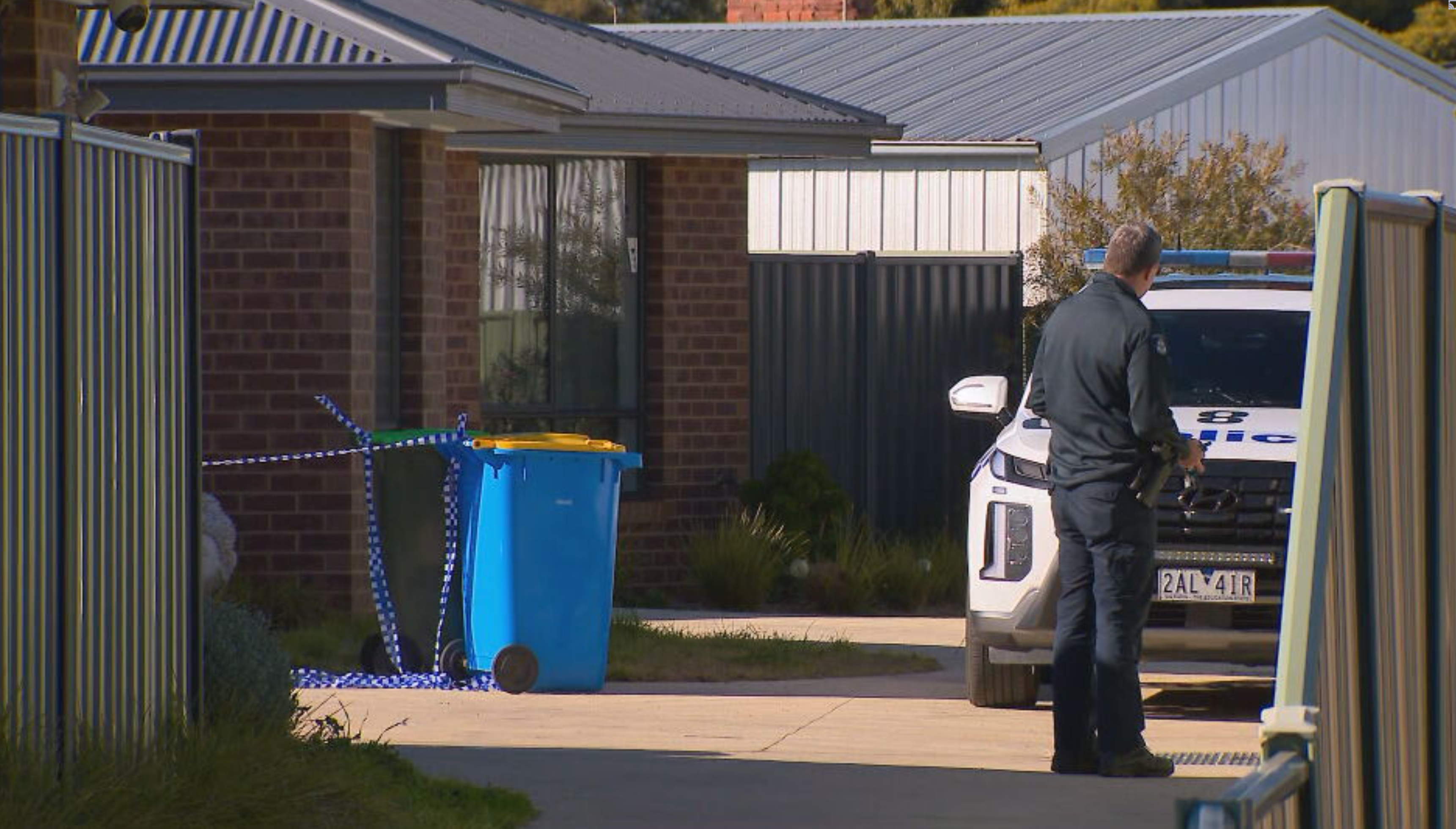
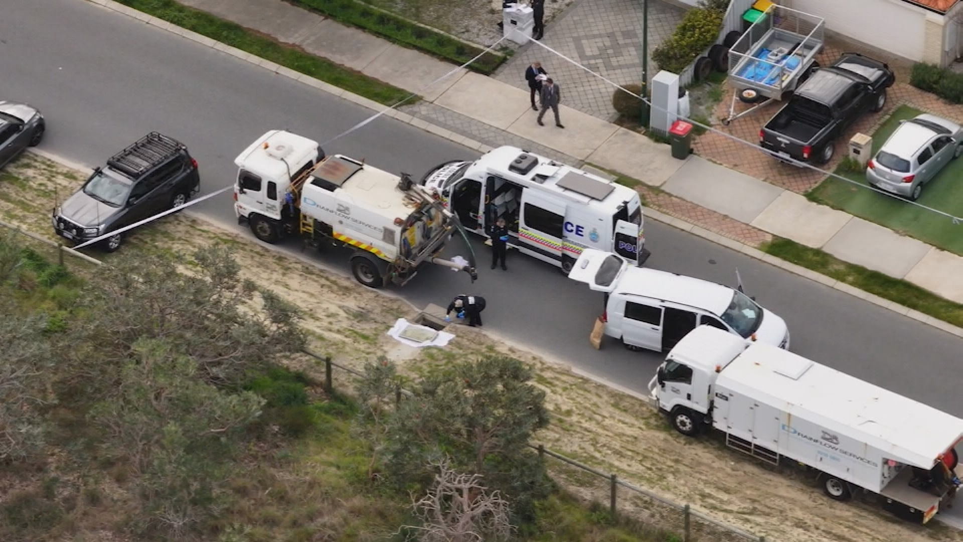 Woman assisting police after baby found in Perth stormwater drain
 Man charged with murder of Cobram woman
 Man who attacked baby with hot coffee remains free in China one year on
 Childcare centres failing to meet national standards named and shamed
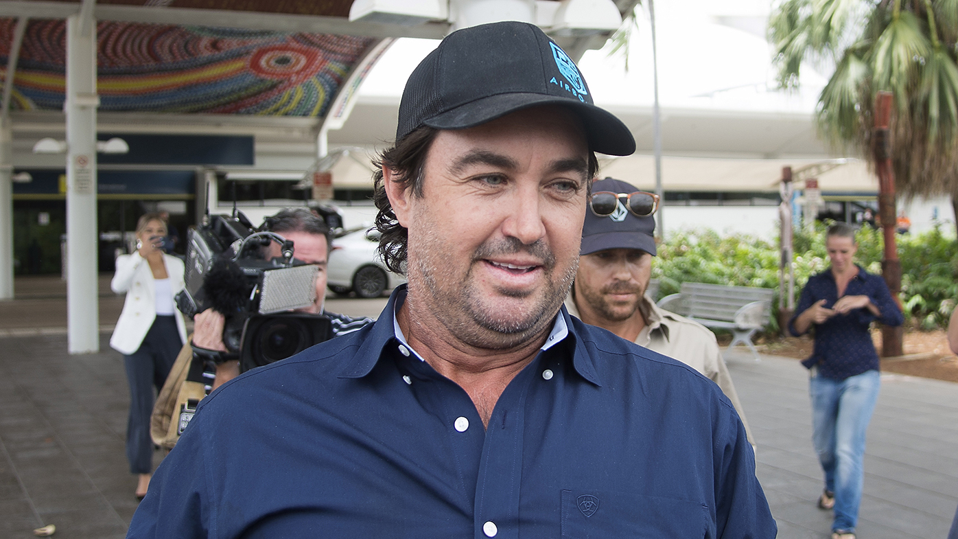 Reality TV star offered $10,000 to injured pilot's family, court hears
 Perth doctor pleads guilty over drunken high-speed crash that killed young woman
 BHP called to foot the bill after fire ant outbreak in Queensland
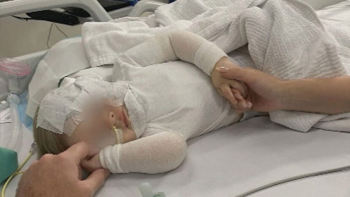
 Toddler's painful shopping centre eye injury sparks call for change
 Beta blockers could halt triple-negative breast cancer, new study suggests
 More Aussies are becoming solo mums by choice. Claire had no other option
 'Zombie squirrels' turning up in backyards and animal shelters across US
 'Hurts every time': Dad hiding kids in bush for three years
 Plane forced to land in Italy after flames erupt mid-air