While Tropical Cyclone Narelle's final destination is still uncertain, the storm brings the promise of a massive "rain dump" on Perth after making landfall.
Tropical Cyclone Narelle has re-formed off the north-west of Western Australia and is barrelling toward the coastline.
While the system's final destination is still uncertain, the storm brings the promise of a massive "rain dump" on Perth after making landfall.
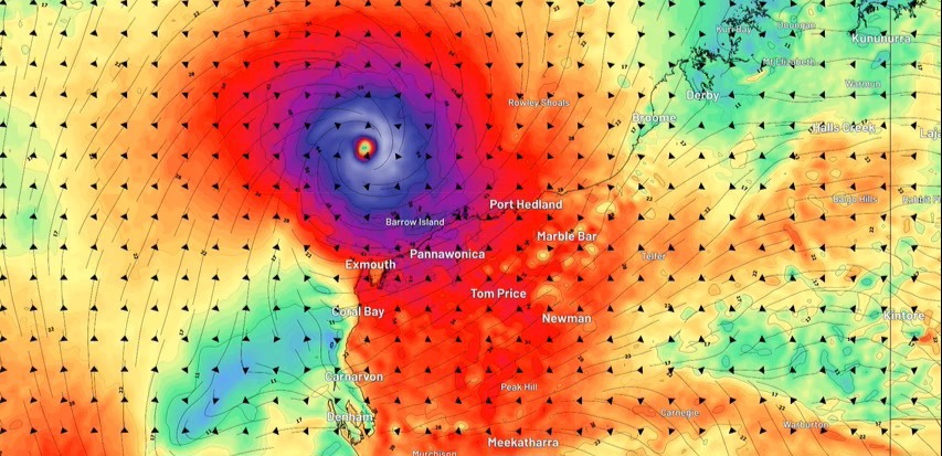
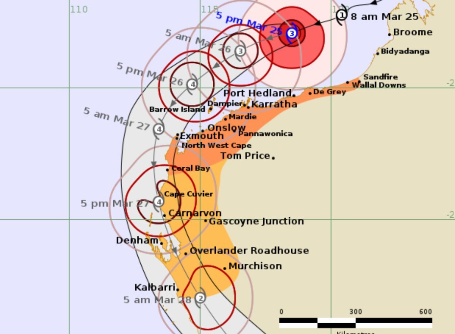
This evening it was a category 3 storm generating wind gusts up to 165km/h less than 300 kilometres off the PIlbara coast near Port Hedland.
READ MORE: Experts liken sky-high fuel prices to three interest rate rises
One possible scenario suggests Narelle could cross Exmouth as a category 5 storm.
Cyclone Vance decimated Exmouth when it hit 27 years ago with 267km/h winds smashing the town.
History could repeat itself this weekend.
"As it continues to move to the west-southwest, offshore from the Pilbara coast, we're expecting [Narelle] to reach category 4 or 5 intensity," James Ashley from the Bureau of Meteorology told 9News.
A category 5 is the most dangerous system, packing winds of more than 200km/h.
Narelle's path is unpredictable. It could hit Exmouth as a category 5 but another forecast model suggests it might track further south and pass over Denham as a category 3.
Either way, Perth is set for a soaking.
"We're expecting rainfall, even in Perth, of 50 millimetres to 100 millimetres over the course of Friday and Saturday," Ashley said.
"So, regardless of the coastal crossing there will be significant rainfall."
Businesses across Perth aren't taking any chances, with a number of events already cancelled, postponed or relocated.
Ice Cream Factory in Northbridge is moving its outdoor event to RAC Arena.
"I think everyone rocking up to a concert and it being cancelled is just not an option for us," organiser Chris Bausor told 9News.
"We value the trust that customers place in us by buying a ticket ahead of time, so moving it to RAC was the only option."
Daryl Braithwaite at Ascot racecourse has been rescheduled but Scarborough Beach Weekender is forging on, with workers starting their set up today.
Rottnest ferries are still going ahead at this stage but the Island Authority is offering free cancellations on campground bookings and boat moorings.
Preparations get under way
It's rare for such a strong system to track so far south.
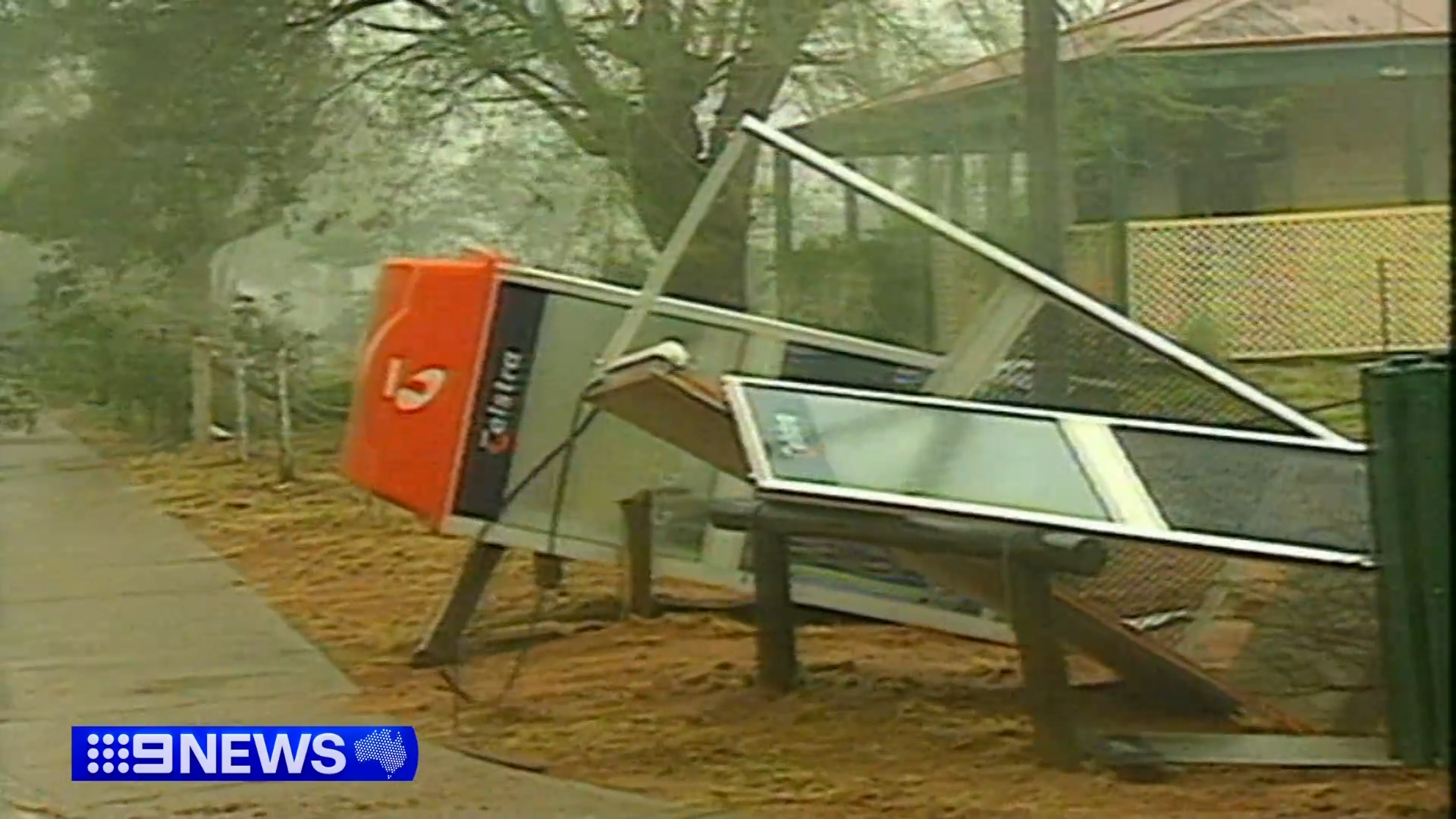
Almost 50 years ago Cyclone Alby brought 150km/h winds to Busselton, killing five people and destroying the iconic jetty.
A decade later Cyclone Ned hit near Rockingham, taking down power lines and damaged property.
WA Premier Roger Cook has asked locals to "heed the advice of emergency services".
"We know you've got experience in dealing with cyclone events but they are unpredictable," he said.
And it looks like some people are taking that advice, with towns in the north of WA beginning to prepare as Narelle gains strength off the coast.
Kalbarri knows how devastating a cyclone can be after being smashed by Seroja almost five years ago.
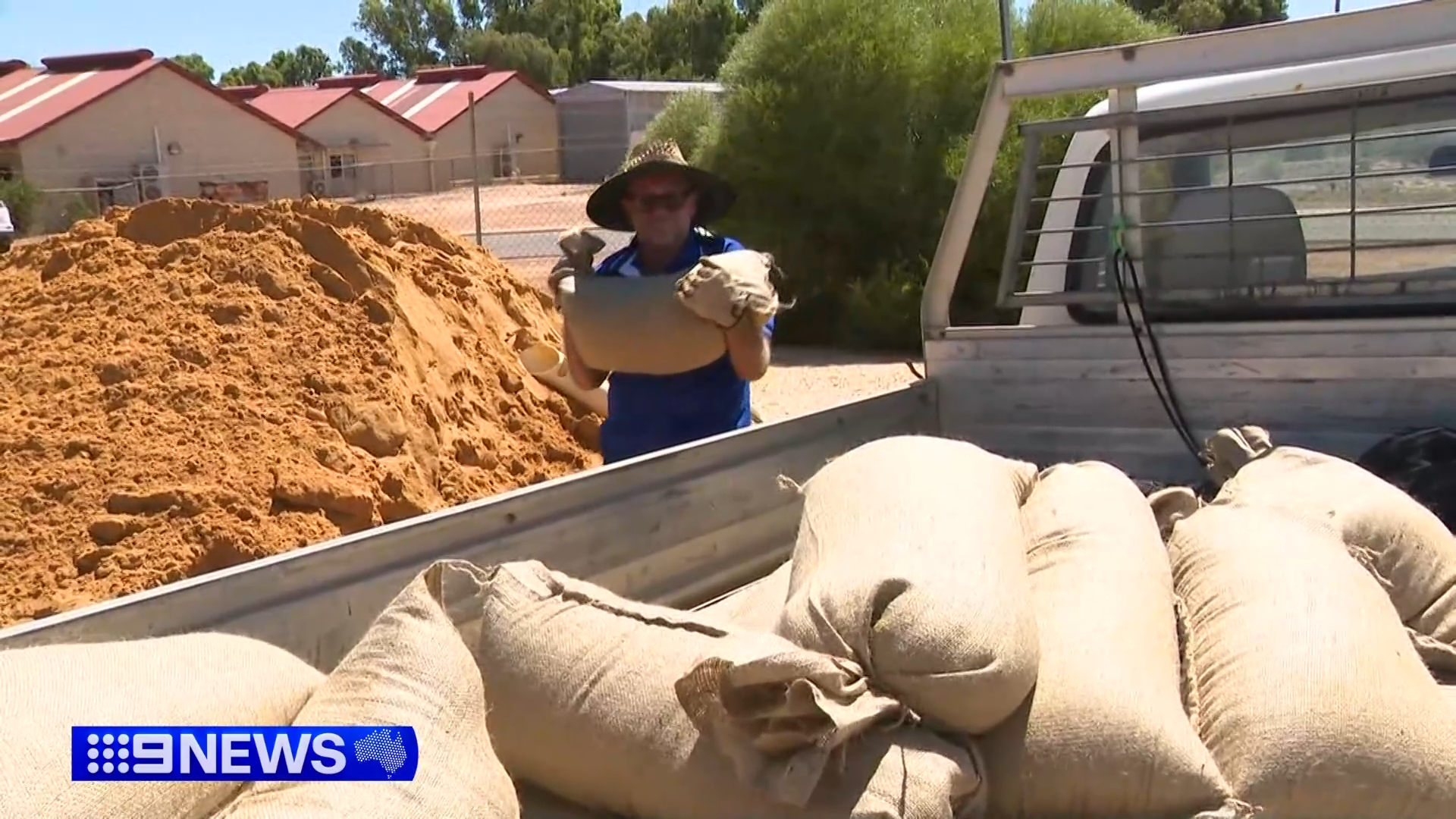
Taking no chances this time around, locals were stocking up on sandbags today.
Caravan parks in Kalbarri, as well as those further north in Denham and Exmouth, are evacuating travellers and turning away any new bookings.
Kalbarri locals spent the day tidying up and even with preparations in full swing, they're hoping for the best.
"I think everyone is just waiting to see what happens, it's an unknown if it's gonna cross here or Carnarvon or Jurien Bay," Graeme Cull from Kalbarri Tudor Holiday Park told 9News.
Mark and Janice Murrie lived through the category 3 cyclone in 2021 and they say locals are scarred.
"There will be a lot of stressed people here," Mr Murrie told 9News.
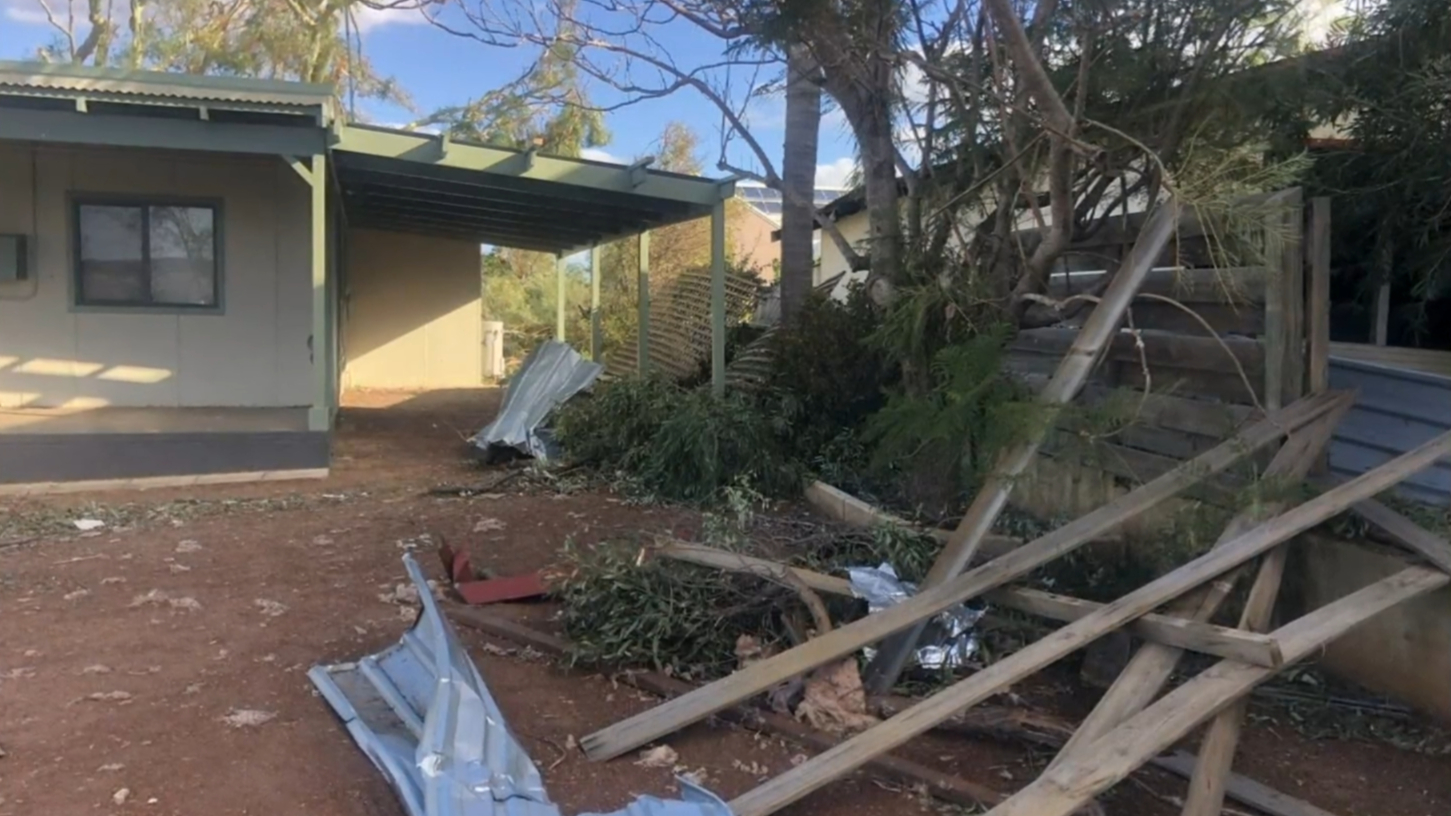
"'Cause the mental health after the last one - people were just shell shocked.
"We were lucky cause we didn't get a lot of damage - a lot of mess but not a lot of damage."
Narelle getting stronger and more unpredictable
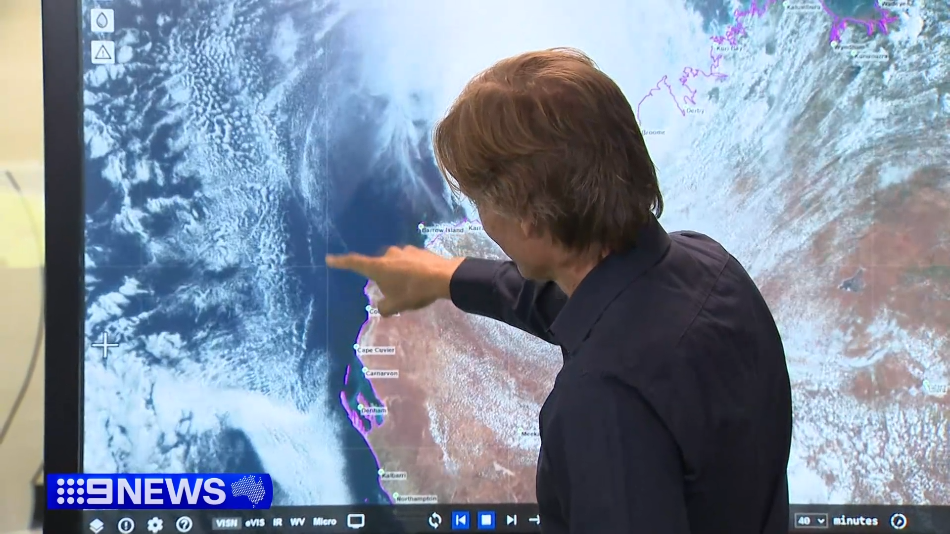
Right now for the people in towns dotted along the Mid West Coast it's a waiting game as Narelle grows stronger and more unpredictable.
It will really ramp up later tomorrow, with very destructive wind gusts up to 260 km/h possible for west of Onslow, as the system moves closer to the North West Cape.
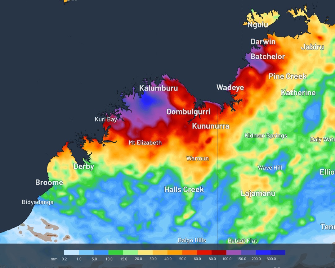
Those wind gusts could extend south to Carnarvon during Friday, which the latest mapping showing the area could take a direct category 4 hit.
Denham could see gusts of close to 200 km/h later on Friday.
The system has already dumped huge rainfall totals, with 177 millimetres recorded in Cygnet Bay, north of Broome.
Narelle's impacts will be felt in Perth on Friday and Saturday.
NEVER MISS A STORY: Get your breaking news and exclusive stories first by following us across all platforms.
- Download the 9NEWS App here via Apple and Google Play
- Make 9News your preferred source on Google by ticking this box here
- Sign up to our breaking newsletter here
 Iran dismisses US ceasefire plan, issues its own counterproposal
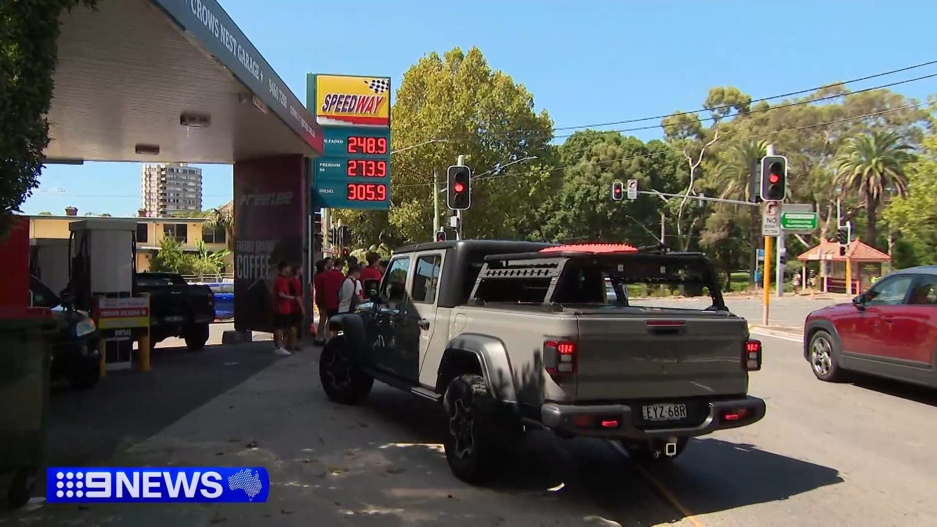 Experts liken sky-high fuel prices to three interest rate rises
 What nation's youngest murderer asked a stranger
 'We are in agony': Savannah Guthrie's first interview since mum's disappearance
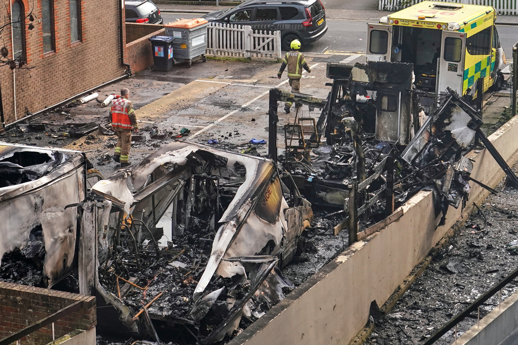 Two arrested over arson attack on UK Jewish charity's ambulances
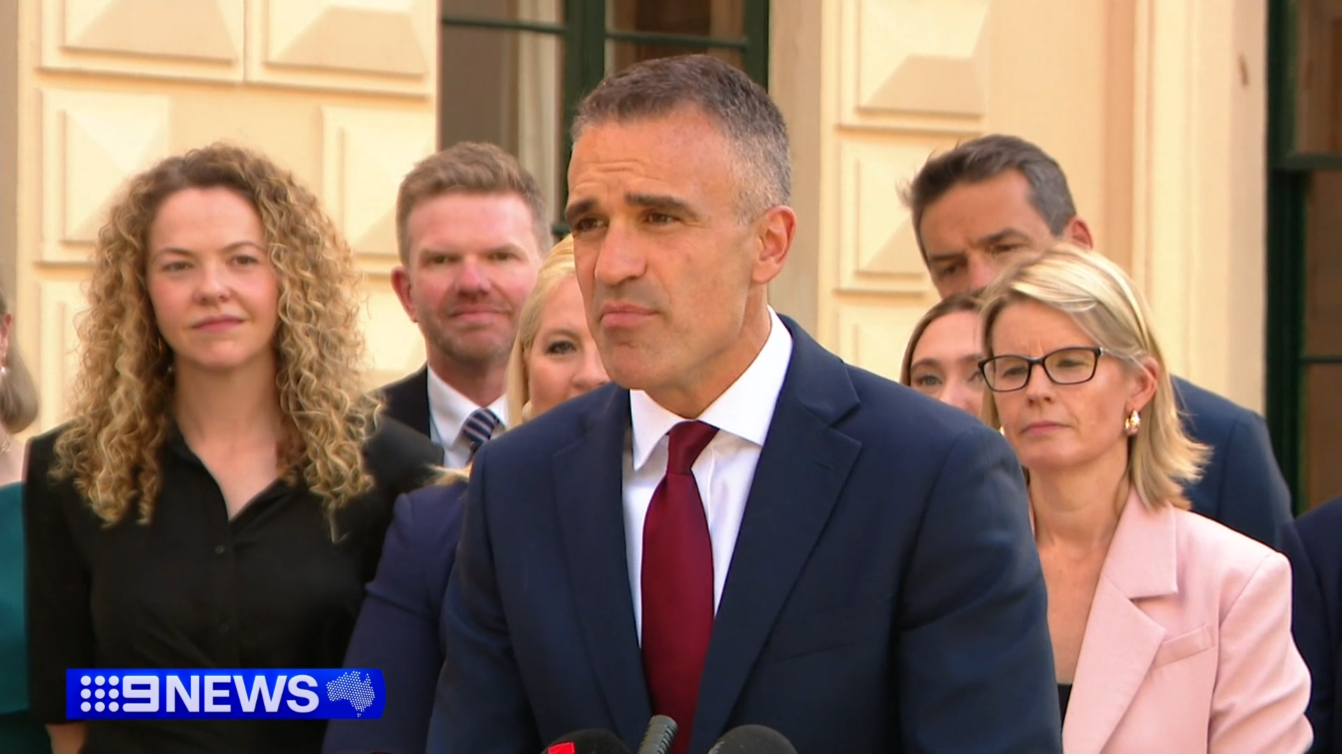 SA premier announces surprise cabinet reshuffle after landslide win
 Urgent recall issued for baby monitor unit over possible battery fire hazard
 'I wish they killed me': Mother left traumatised after violent home invasion
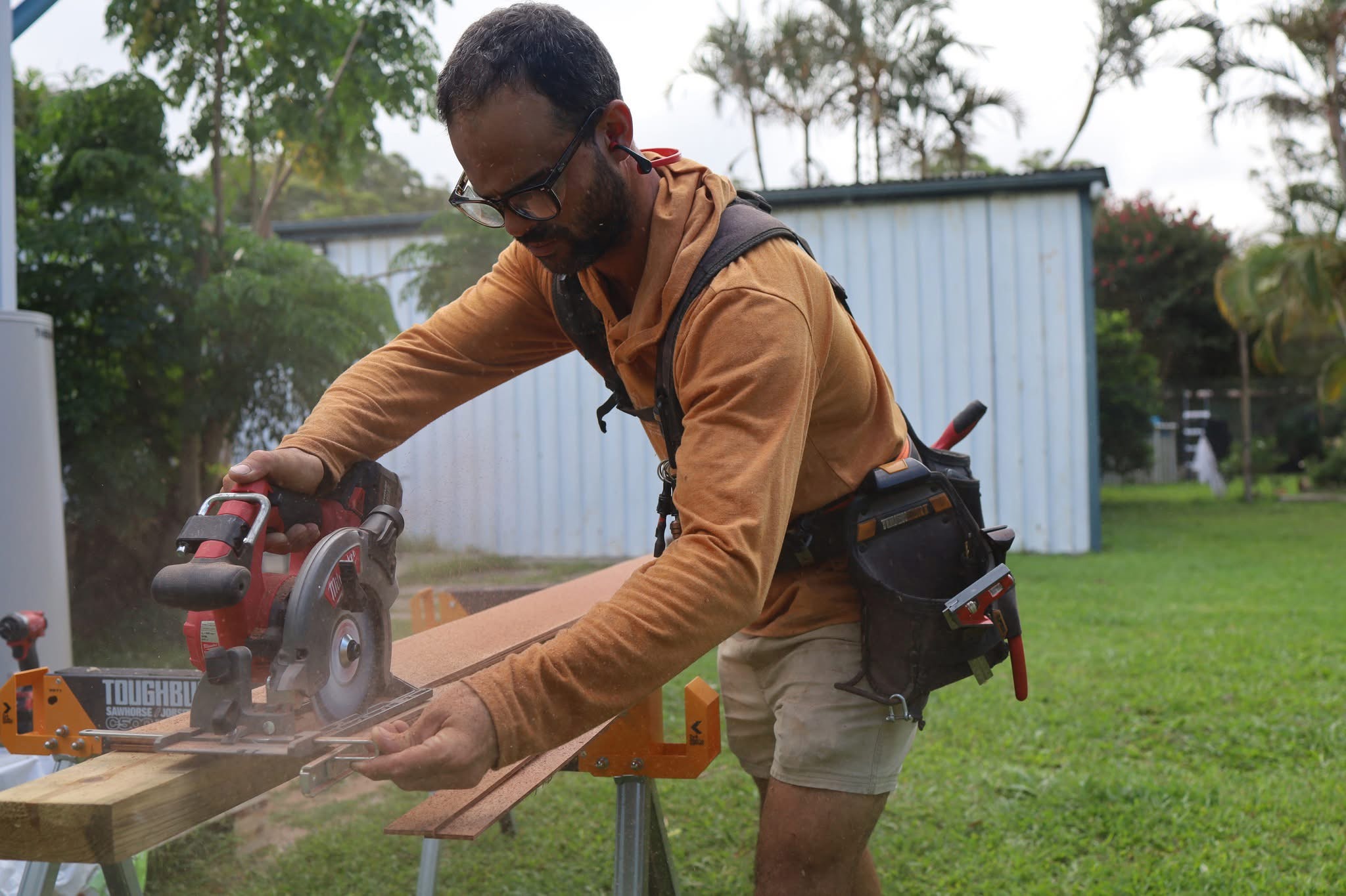 Tradies hit hardest by fuel crisis forced to raise prices or go bust - and every Aussie will pay for it
 'My kids' lives mean nothing': Mum sobs as 'callous' driver jailed
 Identity of 'major player' charged with Sydney grandfather's murder revealed
 Iran looking to turn Strait of Hormuz into massive toll booth
 'They're screaming out for it': Hanson's warning after election shock
 Sydney Opera House sails light up to mark 50 Years of Apple
 Trump on shaky ground after Democrats win Mar-a-Lago seat
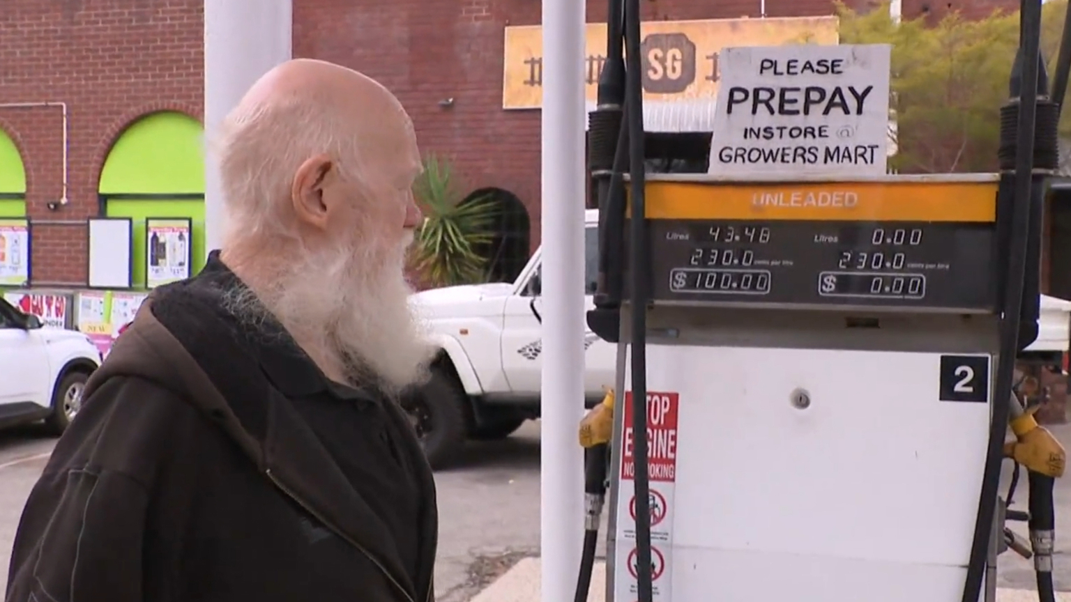 Motorists flock to tiny growers mart selling city's cheapest fuel
 Hours of daily free power to be offered to 2.6 million Aussie households
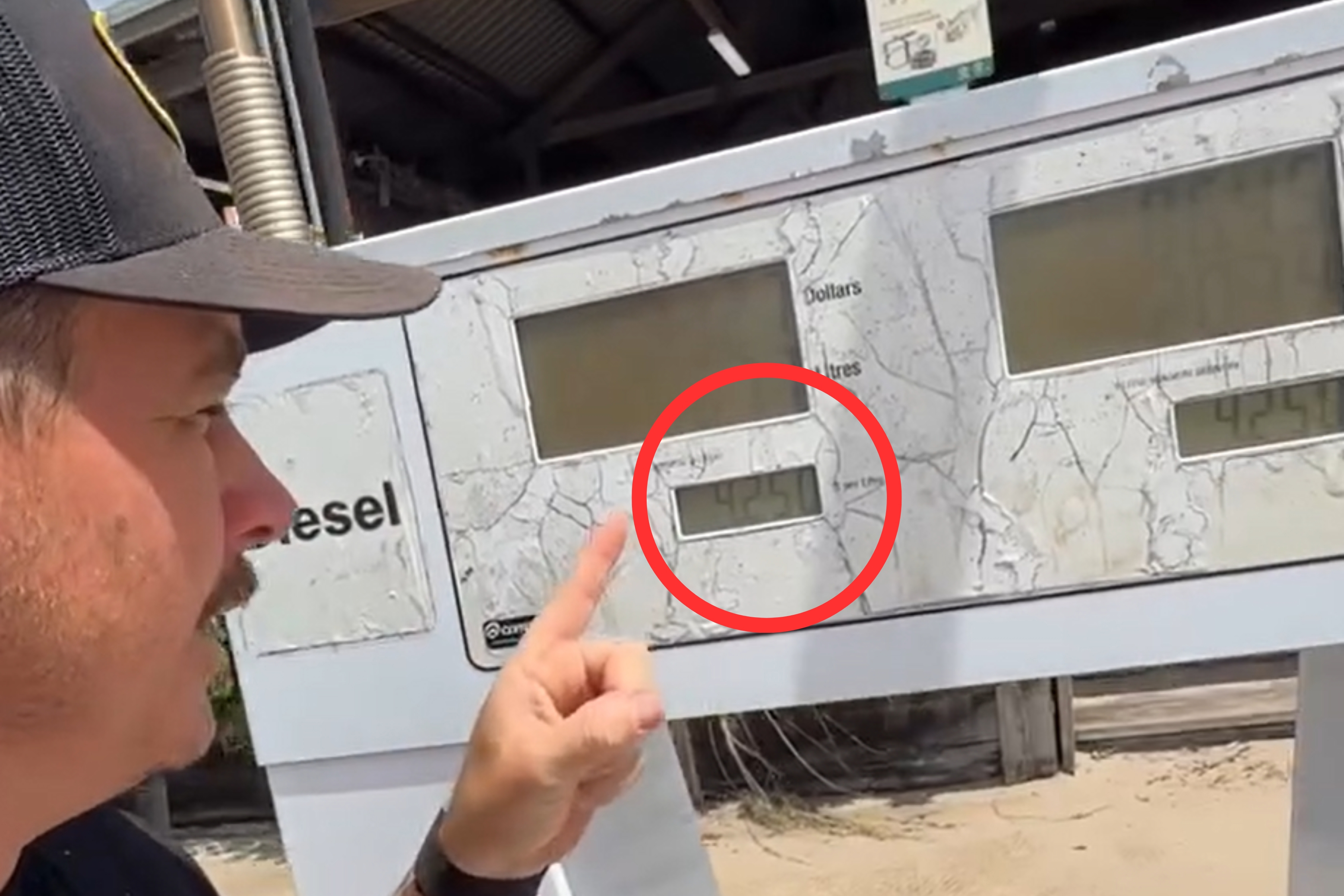 Diesel hits $4.25/litre on K'gari as owner lays bare reality of fuel crisis
 Trump says Iran has sent expensive gift to US, but won't say what it is